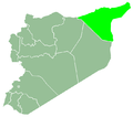
Al-Hasakah_Map.png (672 × 594 pixels, file size: 17 KB, MIME type: image/png)
File history
Click on a date/time to view the file as it appeared at that time.
| Date/Time | Thumbnail | Dimensions | User | Comment | |
|---|---|---|---|---|---|
| current | 15:20, 12 April 2011 |  | 672 × 594 (17 KB) | Goktr001 | {{Information |Description ={{tr|1=Hasiçi Valiliği}} |Source =From tr.wikipedia, user:Berkaysnklf |Author =user:Berkaysnklf |Date =05.12.2010 |Permission = |other_versions = }} tr.wikipedia'dan Commons'a [[User:G |
File usage
There are no pages that use this file.
Global file usage
The following other wikis use this file:
- Usage on ar.wikipedia.org
- Usage on azb.wikipedia.org
- Usage on az.wikipedia.org
- Usage on bn.wikipedia.org
- Usage on ckb.wikipedia.org
- Usage on diq.wikipedia.org
- Usage on en.wikipedia.org
- Qamishli
- Al-Hasakah Governorate
- Tell Brak
- Tell Tamer
- Dakhiliyah
- Al-Hasakah
- Amuda
- Al-Malikiyah
- Ras al-Ayn
- Al-Dirbasiyah
- Qamishli District
- Ras al-Ayn District
- Al-Malikiyah District
- Al-Hasakah District
- Al-Alwa
- Qasrok, Syria
- Al-Khalidiyah, al-Hasakah Governorate
- Al-Muabbada
- Al-Qahtaniyah, al-Hasakah
- Template:Al-Hasakah Governorate
- Al-Shaddadah
- Al-Sabaa wa Arbain
- Mount Abdulaziz
- Rmelan
- Template:AlHasakahSY-geo-stub
- Tell Hamis
- Tell Brak (village)
- Al-Madinah, Al-Hasakah
- Al-Aziziyah
- Ghuwayran
- Al-Nasra
- Al-Nashwa
- Umm al Quşayr, Al-Hasakah
- Al-Manajir
- Mabrouka
- Al-Jawadiyah
- Al-Yaarubiyah
- Al-Tweinah
- Al-Fadghami
- Tell Safouk
- Markada
- Bir al-Helou
View more global usage of this file.


 Français
 Italiano


