
 Français
 Italiano
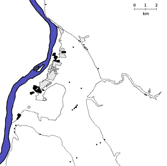
No higher resolution available.
Amarna_map_large.jpg (553 × 549 pixels, file size: 29 KB, MIME type: image/jpeg)
This is a file from the Wikimedia Commons and may be used by other projects. Information from its description page there is shown below. Commons is a freely licensed media file repository. |


This file is licensed under the Creative Commons Attribution-Share Alike 2.5 Generic license.
- You are free:
- to share – to copy, distribute and transmit the work
- to remix – to adapt the work
- Under the following conditions:
- attribution – You must give appropriate credit, provide a link to the license, and indicate if changes were made. You may do so in any reasonable manner, but not in any way that suggests the licensor endorses you or your use.
- share alike – If you remix, transform, or build upon the material, you must distribute your contributions under the same or compatible license as the original.
Black and white map of Amarna. This will be used as the basis of an image map in the main article
Creator: Alex Tooley and Mary Talarico
File history
Click on a date/time to view the file as it appeared at that time.
| Date/Time | Thumbnail | Dimensions | User | Comment | |
|---|---|---|---|---|---|
| current | 13:32, 21 July 2007 | | 553 × 549 (29 KB) | Alensha | {{cc-by-sa-2.5}} Black and white map of Amarna. This will be used as the basis of an image map in the main article Creator: en:User:Markh |
File usage
There are no pages that use this file.
Global file usage
The following other wikis use this file:
- Usage on ar.wikipedia.org
- Usage on arz.wikipedia.org
- Usage on ast.wikipedia.org
- Usage on be.wikipedia.org
- Usage on ca.wikipedia.org
- Usage on en.wikipedia.org
- Amarna
- Tomb of Ay at Amarna--Southern Tomb 25
- Royal Wadi and tombs
- Boundary Stelae of Akhenaten
- Tombs of the Nobles (Amarna)
- Southern Tomb 23
- Royal Tomb of Akhenaten
- Workmen's Village, Amarna
- Maru-Aten
- Great Temple of the Aten
- Small Aten Temple
- Amarna Tomb 1
- Southern Tomb 11
- Template:Amarna Image Map
- Bureau of Correspondence of Pharaoh
- North City, Amarna
- Tomb of Meryra
- Template:Amarna Navigator
- Urban planning in ancient Egypt
- Northern Palace (Amarna)
- South Tombs Cemetery, Amarna
- Kom el-Nana
- Amarna Tomb 3
- Amarna Tomb 5
- Amarna Tomb 7
- User:Davidbena/sandbox
- North Riverside Palace
- Tomb of Panehsy
- Anonymous Tombs in Amarna
- User:Kakalarınlordu
- Usage on es.wikipedia.org
- Usage on hu.wikipedia.org
View more global usage of this file.
Metadata
Explore the world

United states
New York

Japan
Tokyo

Singapore
Singapore
