
 Français
 Italiano
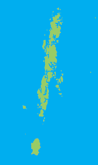
Size of this preview: 356 × 600 pixels. Other resolutions: 142 × 240 pixels | 399 × 672 pixels.
Original file (399 × 672 pixels, file size: 37 KB, MIME type: image/png)
This is a file from the Wikimedia Commons and may be used by other projects. Information from its description page there is shown below. Commons is a freely licensed media file repository. |
Summary
| Description | |
| Source | No machine-readable source provided. Own work assumed (based on copyright claims). |
| Author | No machine-readable author provided. CJLL Wright assumed (based on copyright claims). |
Licensing
I, the copyright holder of this work, hereby publish it under the following licenses:
 | Permission is granted to copy, distribute and/or modify this document under the terms of the GNU Free Documentation License, Version 1.2 or any later version published by the Free Software Foundation; with no Invariant Sections, no Front-Cover Texts, and no Back-Cover Texts. A copy of the license is included in the section entitled GNU Free Documentation License. |
| This file is licensed under the Creative Commons Attribution-Share Alike 3.0 Unported license. | ||
| ||
| This licensing tag was added to this file as part of the GFDL licensing update. |
This file is licensed under the Creative Commons Attribution 2.5 Generic license.
- You are free:
- to share – to copy, distribute and transmit the work
- to remix – to adapt the work
- Under the following conditions:
- attribution – You must give appropriate credit, provide a link to the license, and indicate if changes were made. You may do so in any reasonable manner, but not in any way that suggests the licensor endorses you or your use.
You may select the license of your choice.
File history
Click on a date/time to view the file as it appeared at that time.
| Date/Time | Thumbnail | Dimensions | User | Comment | |
|---|---|---|---|---|---|
| current | 00:38, 22 December 2005 | | 399 × 672 (37 KB) | CJLL Wright | Blank outline map of the Andaman Islands. |
File usage
There are no pages that use this file.
Global file usage
The following other wikis use this file:
- Usage on cs.wikinews.org
- Usage on en.wikipedia.org
- Great Nicobar Biosphere Reserve
- Great Andaman
- Mount Thullier
- Ten Degree Channel
- Andaman district
- Sri Vijaya Puram tehsil
- Rangat
- Ferrargunj
- Nancowry tehsil
- Saddle Peak National Park
- North Button Island National Park
- Galathea National Park
- Template:AndamanNicobar-geo-stub
- Campbell Bay National Park
- Rani Jhansi Marine National Park
- Bombooflat
- Garacharma
- Little Nicobar
- Teressa Island
- Henry Lawrence Island
- Strait Island
- Saddle Peak (Andaman Islands)
- Harinagar, Mayabunder
- Manglutan
- Shibpur, Diglipur
- South Cinque Island
- Bluff Island (Andaman Islands)
- The Sisters (Andaman Islands)
- West Sister Island (Andaman Islands)
- Ramnagar, Diglipur
- Kadamtala, Rangat
- Port Cornwallis
- Landfall Island
- North Reef Island (Andaman Islands)
- Tushnabad
- Kalpong River
- Arong, Car Nicobar
- Tillangchong
- Shompen Village-B
- Kausalya Nagar
- Battimalv Island
- Car Nicobar Subdivision
- Paira Island
- Man Island (Nicobar Islands)
- Bompuka Island
- Kamorta Island
- Nancowry Subdivision
- Meroe Island
- Kondul Island
View more global usage of this file.
Explore the world

United states
New York

Japan
Tokyo

Singapore
Singapore
