
 Français
 Italiano
Size of this PNG preview of this SVG file: 588 × 599 pixels. Other resolutions: 235 × 240 pixels | 471 × 480 pixels | 754 × 768 pixels | 1,005 × 1,024 pixels | 2,009 × 2,048 pixels | 1,720 × 1,753 pixels.
Original file (SVG file, nominally 1,720 × 1,753 pixels, file size: 1.49 MB)
This is a file from the Wikimedia Commons and may be used by other projects. Information from its description page there is shown below. Commons is a freely licensed media file repository. |
Summary
| Camera location | | View this and other nearby images on: OpenStreetMap |
|---|
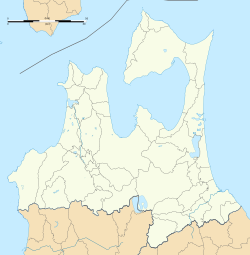
| Description | Deutsch: Karte der Präfektur Aomori. English: Blank map of Aomori Prefecture, for geolocalisation purpose. Español: Mapa de la Prefectura de Aomori. Italiano: Mappa della Prefettura di Aomori. 日本語: 青森県の地図. Português: Carta do Aomori.
| ||
| Date | (UTC) | ||
| Source | Création personnelle ;
| ||
| Author | © Bourrichon (talk) - fr:Bourrichon | ||
| Permission (Reusing this file) |
| ||
| Other versions | File:Aomori-ken géolocalisation relief.svg |
| This SVG file contains embedded text that can be translated into your language, using any capable SVG editor, text editor or the SVG Translate tool. For more information see: About translating SVG files. |
This W3C-unspecified vector image was created with Inkscape .
Licensing
I, the copyright holder of this work, hereby publish it under the following license:
This file is licensed under the Creative Commons Attribution-Share Alike 2.0 France license.
Attribution: Bourrichon (atelier graphique)
- You are free:
- to share – to copy, distribute and transmit the work
- to remix – to adapt the work
- Under the following conditions:
- attribution – You must give appropriate credit, provide a link to the license, and indicate if changes were made. You may do so in any reasonable manner, but not in any way that suggests the licensor endorses you or your use.
- share alike – If you remix, transform, or build upon the material, you must distribute your contributions under the same or compatible license as the original.

File history
Click on a date/time to view the file as it appeared at that time.
| Date/Time | Thumbnail | Dimensions | User | Comment | |
|---|---|---|---|---|---|
| current | 20:53, 1 July 2013 | | 1,720 × 1,753 (1.49 MB) | Bourrichon | == {{int:filedesc}} == {{Location|41|00|00|N|140|00|00|E|scale:5000000}} {{Information |Description= {{fr|Carte vierge de la fr:Préfecture d'Aomori, au Japon, destinée à la géolocalisation.}} {{de|Karte der [[:de:Präfektur Aom... |
File usage
There are no pages that use this file.
Global file usage
The following other wikis use this file:
- Usage on ar.wikipedia.org
- Usage on ceb.wikipedia.org
- Usage on de.wikipedia.org
- Usage on en.wikipedia.org
- Misawa Air Base
- Hachinohe Station
- Shimoda Station
- Aomori Station
- Minmaya Station
- Kanita Station
- Asamushi-Onsen Station
- Kominato Station
- Namioka Station
- Hirosaki Station
- Shin-Aomori Station
- Tsugaru-Shinjō Station
- Tsurugasaka Station
- Nonai Station
- Nishi-Hiranai Station
- Kamikitachō Station
- Ottomo Station
- Yadamae Station
- Koyanagi Station
- Aburakawa Station
- Tsugaru-Miyata Station
- Okunai Station
- Ushirogata Station
- Hirosaki-Higashikōmae Station
- Hiraka Station
- Kuroishi Station (Aomori)
- Kawabe Station (Aomori)
- Yomogita Station
- Tsugaru-Futamata Station
- Okutsugaru-Imabetsu Station
- Ikarigaseki Station
- Daishaka Station
- Kita-Tokiwa Station
- Noheji Station
- Hon-Hachinohe Station
- Hashikami Station
- Sannohe Station
- Metoki Station
- Kizukuri Station
- Ōminato Station
- Shimokita Station
- Ōminato Guard District
- Misawa Station
View more global usage of this file.
Metadata
Explore the world

United states
New York

Japan
Tokyo

Singapore
Singapore
