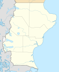
Size of this PNG preview of this SVG file: 493 × 600 pixels. Other resolutions: 197 × 240 pixels | 394 × 480 pixels | 631 × 768 pixels | 842 × 1,024 pixels | 1,683 × 2,048 pixels | 900 × 1,095 pixels.
Original file (SVG file, nominally 900 × 1,095 pixels, file size: 380 KB)
File history
Click on a date/time to view the file as it appeared at that time.
| Date/Time | Thumbnail | Dimensions | User | Comment | |
|---|---|---|---|---|---|
| current | 00:56, 29 December 2022 |  | 900 × 1,095 (380 KB) | Janitoalevic | Precise borders |
| 20:25, 23 November 2022 |  | 900 × 1,095 (257 KB) | GrandEscogriffe | more correct north-south stretching | |
| 23:39, 15 October 2017 |  | 900 × 850 (267 KB) | Janitoalevic | More precise borders. | |
| 11:41, 10 September 2017 |  | 900 × 850 (256 KB) | Milenioscuro | capas | |
| 22:00, 30 April 2016 |  | 900 × 850 (316 KB) | Janitoalevic | Fixed some parts of the coast line and added border in Lake San Martín/O'Higgins | |
| 00:05, 16 April 2016 |  | 900 × 850 (317 KB) | Janitoalevic | Fixed Details | |
| 20:23, 15 April 2016 |  | 900 × 850 (317 KB) | Janitoalevic | Fixed Lakes, Coast lines, International and Internal Borders, Added Disputed Area. | |
| 08:35, 12 March 2016 |  | 900 × 850 (414 KB) | Milenioscuro | Updated borders File:Tierra del Fuego location map.svg, File:Mapa loc Magallanes.svg | |
| 14:59, 14 July 2013 |  | 900 × 850 (602 KB) | Milenioscuro | == {{int:filedesc}} == {{Information |Description={{de|Positionskarte von Santa Cruz (Argentinien)}}{{en|Location map of Santa Cruz province (Argentina)}}{{es|1=Mapa de localización de la Provincia de Santa Cruz.}... |
File usage
There are no pages that use this file.
Global file usage
The following other wikis use this file:
- Usage on ar.wikipedia.org
- Usage on br.wikipedia.org
- Usage on ca.wikipedia.org
- Usage on da.wikipedia.org
- Usage on de.wikipedia.org
- Usage on en.wikipedia.org
- Río Gallegos, Santa Cruz
- Cueva de las Manos
- Viedma Lake
- Puerto Deseado
- El Calafate
- Caleta Olivia
- Pinturas River
- Laguna del Carbón
- San Jorge Gulf
- Posadas Lake
- Puerto Santa Cruz
- Puerto de Punta Quilla
- Glaciarium (museum)
- Isla Pavón
- Potrok Aike
- Del Desierto Lake
- Module:Location map/data/Argentina Santa Cruz
- Module:Location map/data/Argentina Santa Cruz/doc
- Laguna Torre
- Monte Aymond, Argentina
- Onelli Bay
- Usage on eo.wikipedia.org
View more global usage of this file.


 Français
 Italiano


