
 Français
 Italiano
Size of this PNG preview of this SVG file: 502 × 600 pixels. Other resolutions: 201 × 240 pixels | 402 × 480 pixels | 643 × 768 pixels | 857 × 1,024 pixels | 1,714 × 2,048 pixels | 534 × 638 pixels.
Original file (SVG file, nominally 534 × 638 pixels, file size: 510 KB)
This is a file from the Wikimedia Commons and may be used by other projects. Information from its description page there is shown below. Commons is a freely licensed media file repository. |
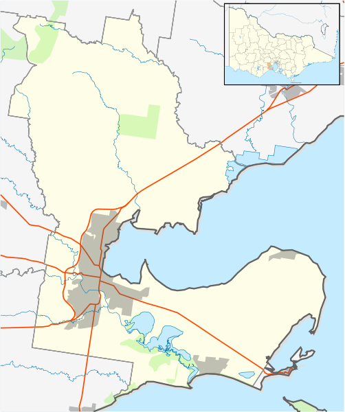
| Description | English: Blank map of w:Loddon Shire, Victoria, Australia, with the following information shown:
Geographic limits:
| ||
| Source | Own work + VicMap Lite | ||
| Author | Cassowary |

File history
Click on a date/time to view the file as it appeared at that time.
| Date/Time | Thumbnail | Dimensions | User | Comment | |
|---|---|---|---|---|---|
| current | 12:52, 18 February 2011 | | 534 × 638 (510 KB) | Cassowary | {{Information |Description ={{en|1=Blank map of w:Loddon Shire, Victoria, Australia, with the following information shown: * LGA boundaries * Coastline, lakes and rivers * Roads and railways * Urban areas * Parks Geographic limits: * North: 37.79S |
File usage
There are no pages that use this file.
Global file usage
The following other wikis use this file:
- Usage on ar.wikipedia.org
- Usage on ceb.wikipedia.org
- Usage on en.wikipedia.org
- Geelong
- City of Greater Geelong
- Avalon, Victoria
- Avalon Airport
- Ocean Grove, Victoria
- Corio, Victoria
- Grovedale, Victoria
- Lovely Banks
- Little River, Victoria
- Waurn Ponds
- Lara, Victoria
- North Shore, Victoria
- Fyansford
- Norlane
- Indented Head
- Moolap, Victoria
- Breakwater, Victoria
- Clifton Springs, Victoria
- Whittington, Victoria
- Leopold, Victoria
- Bell Park
- Manifold Heights
- Wandana Heights
- Wallington, Victoria
- North Geelong
- Geelong West
- Drumcondra, Victoria
- Newtown, Victoria
- St Albans Park
- Highton
- Bell Post Hill
- Belmont, Victoria
- Newcomb, Victoria
- Herne Hill, Victoria
- East Geelong
- Rippleside, Victoria
- Hamlyn Heights
- Drysdale, Victoria
- Barwon Heads, Victoria
- Ceres, Victoria
- South Geelong
- Portarlington, Victoria
- Anakie, Victoria
- Point Lonsdale
- St Leonards, Victoria
- Geelong Ring Road
- Mount Duneed
- Marshall, Victoria
View more global usage of this file.
Explore the world

United states
New York

Japan
Tokyo

Singapore
Singapore
