
 Français
 Italiano
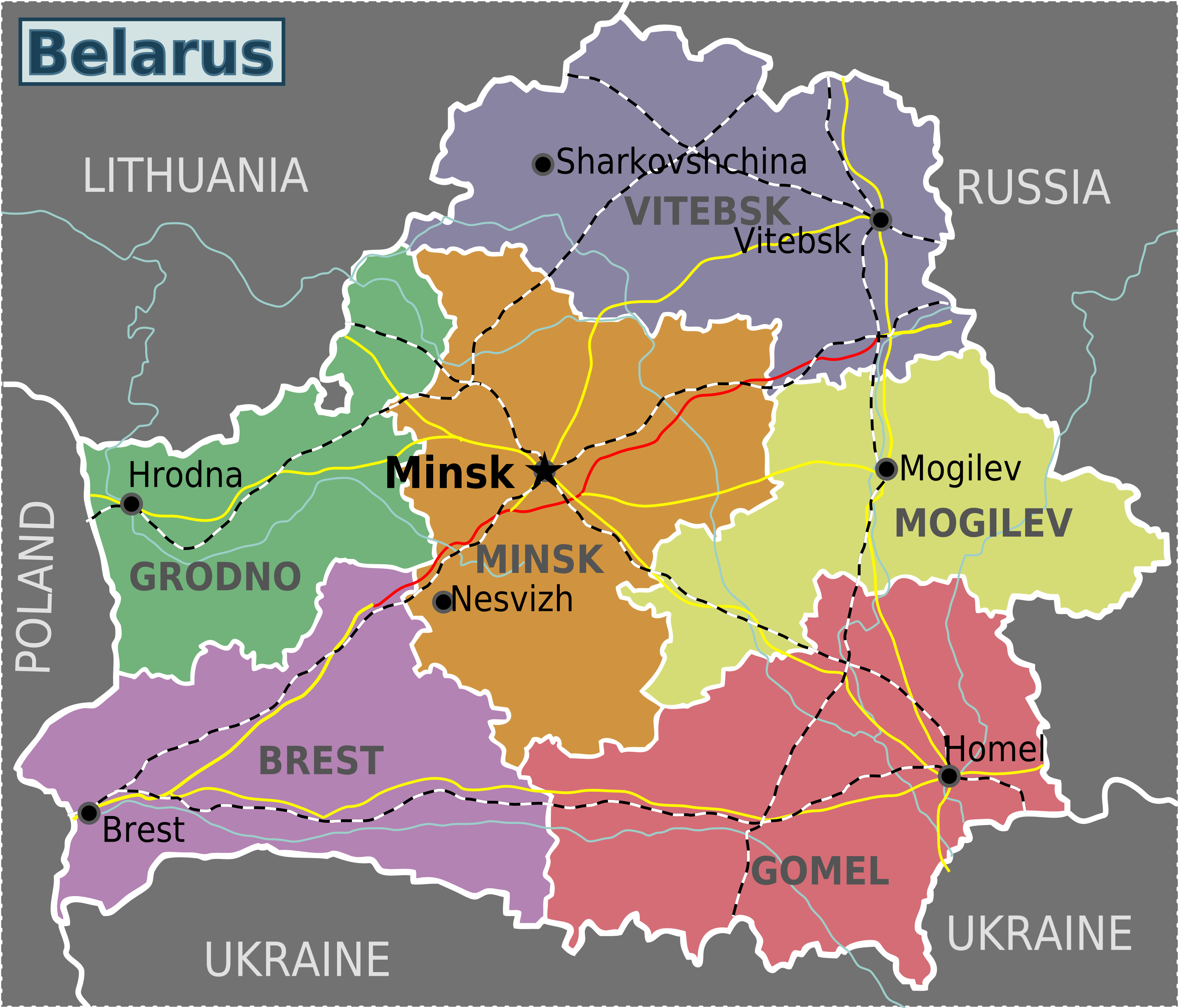
Size of this preview: 702 × 600 pixels. Other resolutions: 281 × 240 pixels | 562 × 480 pixels | 899 × 768 pixels | 1,199 × 1,024 pixels | 2,397 × 2,048 pixels | 2,858 × 2,442 pixels.
Original file (2,858 × 2,442 pixels, file size: 1,016 KB, MIME type: image/png)
This is a file from the Wikimedia Commons and may be used by other projects. Information from its description page there is shown below. Commons is a freely licensed media file repository. |
| Description | Regional map of Belarus (Wikivoyage regional scheme), English version | ||
| Date | |||
| Source | Own work based on the blank map of Belarus | ||
| Author | Arz, Stefan Ertmann | ||
| Permission (Reusing this file) | This file is licensed under the Creative Commons Attribution-Share Alike 3.0 Unported license.
| ||
| Other versions |

.png)
.png)
File history
Click on a date/time to view the file as it appeared at that time.
| Date/Time | Thumbnail | Dimensions | User | Comment | |
|---|---|---|---|---|---|
| current | 12:03, 28 April 2013 | | 2,858 × 2,442 (1,016 KB) | Voll | Text moved to new layers in SVG, created english, russian and ukrainian layers |
| 00:35, 9 April 2011 |  | 653 × 563 (193 KB) | Innotata | {{Information |Description ={{en|1=Graphic map of Belarus provinces}} |Source =[http://wikitravel.org/shared/Image:Belarus_provinces.png Image:Belarus_provinces.png] on Wikitravel, based on File:Belarus provinces blank.svg on Wikimedia Com |
File usage
The following page uses this file:
Global file usage
The following other wikis use this file:
- Usage on bn.wikivoyage.org
- Usage on cs.wikivoyage.org
- Usage on el.wikivoyage.org
- Usage on en.wikipedia.org
- Usage on eo.wikivoyage.org
- Usage on fa.wikivoyage.org
- Usage on fr.wikipedia.org
- Usage on fr.wikivoyage.org
- Usage on he.wikivoyage.org
- Usage on id.wikivoyage.org
- Usage on incubator.wikimedia.org
- Usage on it.wikivoyage.org
- Usage on pt.wikivoyage.org
- Usage on scn.wikipedia.org
- Usage on vi.wikivoyage.org
Metadata
Explore the world

United states
New York

Japan
Tokyo

Singapore
Singapore
