
 Français
 Italiano
Size of this PNG preview of this SVG file: 530 × 599 pixels. Other resolutions: 212 × 240 pixels | 425 × 480 pixels | 679 × 768 pixels | 906 × 1,024 pixels | 1,812 × 2,048 pixels | 622 × 703 pixels.
Original file (SVG file, nominally 622 × 703 pixels, file size: 148 KB)
This is a file from the Wikimedia Commons and may be used by other projects. Information from its description page there is shown below. Commons is a freely licensed media file repository. |
Summary
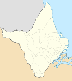
| Description | Location map of Amapá state. Geographic limits of the map:
|
| Date | (UTC) |
| Source | This file was derived from: Amapa MesoMicroMunicip.svg |
| Author |
|
| Other versions | Derivative works of this file: Brazil Para e Amapá Delta do Amazonas RM Macapá e Belém.svg |
Licensing
I, the copyright holder of this work, hereby publish it under the following licenses:
This file is licensed under the Creative Commons Attribution 2.5 Generic license.
- You are free:
- to share – to copy, distribute and transmit the work
- to remix – to adapt the work
- Under the following conditions:
- attribution – You must give appropriate credit, provide a link to the license, and indicate if changes were made. You may do so in any reasonable manner, but not in any way that suggests the licensor endorses you or your use.
| This file is licensed under the Creative Commons Attribution-Share Alike 3.0 Unported license. | ||
| ||
| This licensing tag was added to this file as part of the GFDL licensing update. |
 | Permission is granted to copy, distribute and/or modify this document under the terms of the GNU Free Documentation License, Version 1.2 or any later version published by the Free Software Foundation; with no Invariant Sections, no Front-Cover Texts, and no Back-Cover Texts. A copy of the license is included in the section entitled GNU Free Documentation License. |
You may select the license of your choice.
Uploaded with derivativeFX
File history
Click on a date/time to view the file as it appeared at that time.
| Date/Time | Thumbnail | Dimensions | User | Comment | |
|---|---|---|---|---|---|
| current | 20:27, 20 January 2019 | | 622 × 703 (148 KB) | Milenioscuro | Does not match with the color conventions |
| 23:16, 19 January 2019 |  | 497 × 562 (182 KB) | Allice Hunter | Gráficos | |
| 09:47, 10 February 2012 |  | 622 × 703 (148 KB) | Milenioscuro | == {{int:filedesc}} == {{Information |Description=Location map of Amapá state |Source={{Derived from|Amapa_MesoMicroMunicip.svg|display=50}} |Date=2012-02-10 09:46 (UTC) |Author=*File:Amapa_MesoMicroMunicip.svg: Raphael Lorenzeto de Abreu *derivati |
File usage
There are no pages that use this file.
Global file usage
The following other wikis use this file:
- Usage on ca.wikipedia.org
- Usage on de.wikipedia.org
- Usage on en.wikipedia.org
- Fazendinha
- Parque Arqueológico do Solstício
- Lourenço
- Palikur
- Macapá International Airport
- Clevelândia do Norte
- 2014 Amapá gubernatorial election
- Rio Curiaú Environmental Protection Area
- Fortaleza de São José de Macapá
- Cunani, Calçoene
- Kumenê
- Module:Location map/data/Amapá
- Karipuna do Amapá
- Module:Location map/data/Amapá/doc
- Manga, Amapá
- Kumarumã
- São José dos Galibi
- Vila Velha do Cassiporé
- Sucuriju
- Ilha de Santana
- Pirativa
- Oiapoque Airport
- Bailique
- Igarapé do Lago
- Cachaço, Brazil
- Carvão
- Mazagão Velho
- São Francisco do Iratapuru
- Carapanantuba
- 2023 Campeonato Amapaense
- Anauerapucu
- Usage on es.wikipedia.org
- Usage on fr.wikipedia.org
View more global usage of this file.
Metadata
Explore the world

United states
New York

Japan
Tokyo

Singapore
Singapore
