
 Français
 Italiano
Size of this PNG preview of this SVG file: 519 × 599 pixels. Other resolutions: 208 × 240 pixels | 416 × 480 pixels | 665 × 768 pixels | 887 × 1,024 pixels | 1,773 × 2,048 pixels | 1,233 × 1,424 pixels.
Original file (SVG file, nominally 1,233 × 1,424 pixels, file size: 1.29 MB)
This is a file from the Wikimedia Commons and may be used by other projects. Information from its description page there is shown below. Commons is a freely licensed media file repository. |
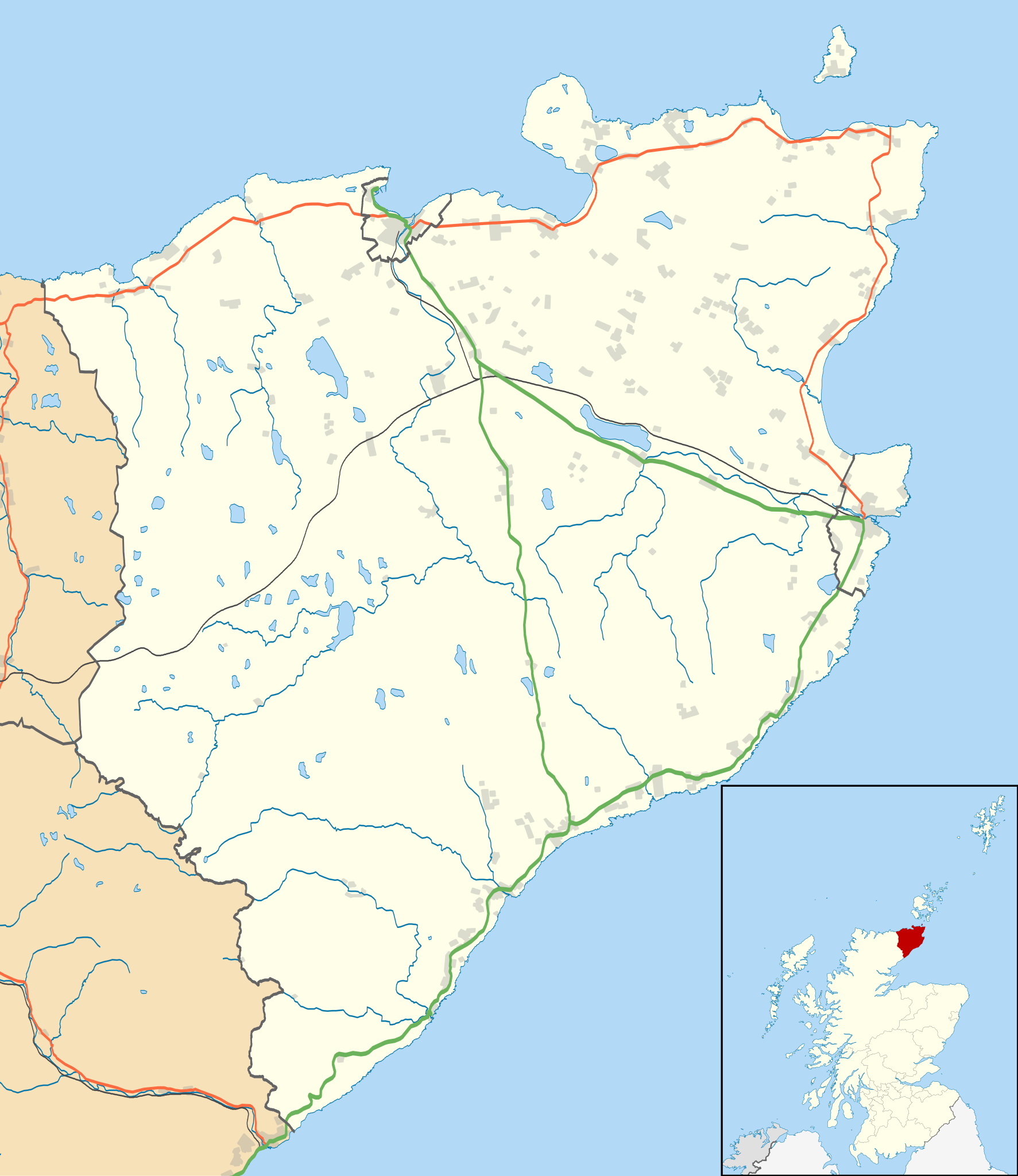
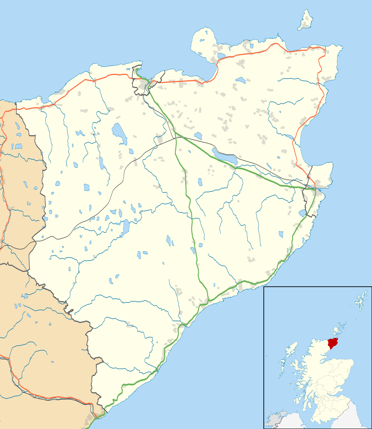
| Description | Blank map of the Caithness ward management area, UK in 2011, with the following information shown:
Equirectangular map projection on WGS 84 datum, with N/S stretched 180% Geographic limits:
|
| Date | |
| Source |
|
| Author | Nilfanion, created using Ordnance Survey data |
| Permission (Reusing this file) | This file is licensed under the Creative Commons Attribution-Share Alike 3.0 Unported license. Attribution: Contains Ordnance Survey data © Crown copyright and database right
|
| Other versions | File:Caithness UK blank map.svg - Blank map |
File history
Click on a date/time to view the file as it appeared at that time.
| Date/Time | Thumbnail | Dimensions | User | Comment | |
|---|---|---|---|---|---|
| current | 11:11, 10 February 2011 | | 1,233 × 1,424 (1.29 MB) | Nilfanion | {{Information |Description=Blank map of the Caithness ward management area, UK in 2011, with the following information shown: *Ward boundaries *Coastline, lakes and rivers *Roads and railways *Urban areas Equirectangular map projection on |
File usage
There are no pages that use this file.
Global file usage
The following other wikis use this file:
- Usage on ar.wikipedia.org
- Usage on ceb.wikipedia.org
- Usage on en.wikipedia.org
- Castle of Mey
- Thurso
- Halkirk
- Latheronwheel
- Castletown, Highland
- Haster
- Dunnet
- Latheron
- Caithness General Hospital
- Georgemas
- Reay
- Watten, Highland
- Altnabreac
- Achreamie
- Ackergill
- Skarfskerry
- Lybster
- Nybster
- Fresgoe
- Dunbeath
- Harmsworth Park
- Scrabster
- Ackergill Tower
- Bilbster
- Borgue, Highland
- Staxigoe
- Brabsterdorran
- Braemore
- Broubster
- Ulbster
- Bower, Highland
- Gillock
- Freswick
- Thrumster, Caithness
- Ham, Caithness
- Huna, Caithness
- Whaligoe
- Auckengill
- Achvarasdal
- Achingills
- Bruan
- Buldoo
- Balnabruich
- Papigoe
- Houstry
- Keiss
- Swiney
View more global usage of this file.
Explore the world

United states
New York

Japan
Tokyo

Singapore
Singapore
