
 Français
 Italiano
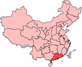
No higher resolution available.
China-Guangdong.png (268 × 218 pixels, file size: 31 KB, MIME type: image/png)
This is a file from the Wikimedia Commons and may be used by other projects. Information from its description page there is shown below. Commons is a freely licensed media file repository. |
en: Location of Guangdong Province in the People's Republic of China. See Locator maps of province-level divisions of the People's Republic of China for more information.
zh: 廣東省在中華人民共和國的位置。另見Locator maps of province-level divisions of the People's Republic of China。
 | Permission is granted to copy, distribute and/or modify this document under the terms of the GNU Free Documentation License, Version 1.2 or any later version published by the Free Software Foundation; with no Invariant Sections, no Front-Cover Texts, and no Back-Cover Texts. A copy of the license is included in the section entitled GNU Free Documentation License. |
| This file is licensed under the Creative Commons Attribution-Share Alike 3.0 Unported license. | ||
| ||
| This licensing tag was added to this file as part of the GFDL licensing update. |
 | File:Map of PRC Guangdong.svg is a vector version of this file. It should be used in place of this PNG file when not inferior. File:China-Guangdong.png → File:Map of PRC Guangdong.svg For more information, see Help:SVG. |  |
File history
Click on a date/time to view the file as it appeared at that time.
| Date/Time | Thumbnail | Dimensions | User | Comment | |
|---|---|---|---|---|---|
| current | 14:03, 28 October 2007 | | 268 × 218 (31 KB) | Croquant | transparent background |
| 22:35, 4 June 2005 |  | 268 × 218 (9 KB) | Ran | '''en''': Location of Guangdong Province in the People's Republic of China. See Category:Locator maps of province-level divisions of the People's Republic of China for more information. '''zh''': 廣東省在中華人民共和國的位置。另見[[ |
File usage
There are no pages that use this file.
Global file usage
The following other wikis use this file:
- Usage on da.wikipedia.org
- Usage on en.wikipedia.org
- Bei River
- Meixian, Meizhou
- Xingning, Guangdong
- Sihui
- Leizhou
- Wangniudun
- Xingning Air Base
- Wikipedia:WikiProject Chinese provinces/Locator maps
- Chashan
- Ning River
- Shenguang Mountain
- Yingde
- Shiwanzhen Subdistrict
- Guanghai
- Haiyan, Guangdong
- Xingning Basin
- Qiongzhou Strait
- Chang'an, Dongguan
- Yingdehong tea
- Haifeng County
- Zhongshan Island
- Baisha, Taishan
- Sanhe, Taishan
- Dongzhou, Guangdong
- Liannan Yao Autonomous County
- Jiaoling County
- Nanhai, Foshan
- Chaoyang, Shantou
- Jianying Memorial Bridge
- Xinyi, Guangdong
- Fengshun County
- Template:Guangdong-geo-stub
- Dabu County
- Meizhou Meixian Airport
- Shantou Waisha Airport
- Zhanjiang Airport
- Changping, Guangdong
- Huilai County
- Shuibu
- Huacheng
- Zhaoqing railway station
- Egongling River
- Longhua Subdistrict, Shenzhen
- Longjiang, Foshan
- Lecong
- Zhangmutou
- Fenggang, Dongguan
- Xingtan, Guangdong
View more global usage of this file.
Explore the world

United states
New York

Japan
Tokyo

Singapore
Singapore
