
 Français
 Italiano
Size of this PNG preview of this SVG file: 512 × 579 pixels. Other resolutions: 212 × 240 pixels | 424 × 480 pixels | 679 × 768 pixels | 905 × 1,024 pixels | 1,811 × 2,048 pixels.
Original file (SVG file, nominally 512 × 579 pixels, file size: 1.07 MB)
This is a file from the Wikimedia Commons and may be used by other projects. Information from its description page there is shown below. Commons is a freely licensed media file repository. |
Summary
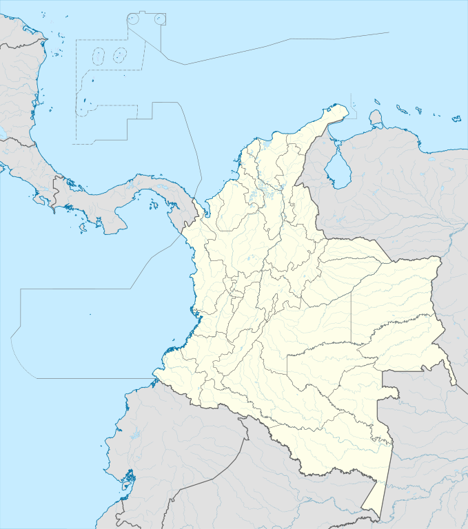
| Description | English: Location map of Colombia Equirectangular projection. Geographic limits of the map:
|
| Date | |
| Source | Own work (Original text: own work, using Demis data) |
| Author | Milenioscuro |
| Other versions | Derivative works of this file: Bajo Nuevo Colombia location.png
|
| SVG development | This W3C-invalid map was created with Adobe Illustrator. |


.svg)

Licensing
Milenioscuro, the copyright holder of this work, hereby publishes it under the following license:
This file is licensed under the Creative Commons Attribution-Share Alike 3.0 Unported license.
Attribution: Milenioscuro
- You are free:
- to share – to copy, distribute and transmit the work
- to remix – to adapt the work
- Under the following conditions:
- attribution – You must give appropriate credit, provide a link to the license, and indicate if changes were made. You may do so in any reasonable manner, but not in any way that suggests the licensor endorses you or your use.
- share alike – If you remix, transform, or build upon the material, you must distribute your contributions under the same or compatible license as the original.
| Annotations | This image is annotated: View the annotations at Commons |


File history
Click on a date/time to view the file as it appeared at that time.
| Date/Time | Thumbnail | Dimensions | User | Comment | |
|---|---|---|---|---|---|
| current | 20:17, 22 February 2022 | | 512 × 579 (1.07 MB) | Milenioscuro | standard colors |
| 11:10, 1 December 2017 |  | 2,027 × 2,294 (1.37 MB) | Milenioscuro | limits | |
| 11:00, 1 December 2017 |  | 2,027 × 2,294 (1.37 MB) | Milenioscuro | more visible limits | |
| 05:48, 28 January 2014 |  | 2,027 × 2,294 (1.39 MB) | Milenioscuro | correction of departamental, international and maritime boundaries, courses of rivers, coastline, and line thickness | |
| 17:01, 29 May 2012 |  | 2,007 × 2,298 (1.07 MB) | Milenioscuro | correction of some departamental borders | |
| 18:58, 26 March 2012 |  | 2,007 × 2,298 (1.08 MB) | Milenioscuro | correction of international borders, added layers, rivers, etc | |
| 08:12, 17 November 2011 |  | 2,007 × 2,298 (1.04 MB) | Milenioscuro | simplification of rivers, correction of some borders | |
| 23:48, 2 November 2009 |  | 2,007 × 2,298 (1.14 MB) | Milenioscuro | thick boundaries of departments | |
| 09:10, 1 November 2009 |  | 2,007 × 2,298 (1.15 MB) | Milenioscuro | Adjusted to match style of location maps 2008 | |
| 07:30, 26 October 2009 |  | 2,268 × 2,676 (1.4 MB) | Milenioscuro | maritime boundaries |
File usage
There are no pages that use this file.
Global file usage
The following other wikis use this file:
- Usage on af.wikipedia.org
- Usage on als.wikipedia.org
- Usage on an.wikipedia.org
- Usage on ar.wikipedia.org
- Usage on ast.wikipedia.org
- Bogotá
- Cali
- Estadiu Doce de Octubre
- Puerto Colombia (Guainía)
- González (Cesar)
- Estadiu Deportivo Cali
- Módulu:Mapa de llocalización/datos/Colombia
- Ríu Magdalena
- Capitoliu Nacional de Colombia
- Comisión Colombiana del Espaciu
- Nevado del Ruiz
- Módulu:Mapa de llocalización/datos/Colombia/usu
- Barranquilla
- Cartagena de Indias
- Estadiu Metropolitanu Roberto Meléndez
- Palenque de San Basilio
- Copa América 2001
- Sierra de Chiribiquete
- Inírida
- Aeropuertu Internacional El Dorado
- Casa d'Adoración Norte del Cauca
- Aeropuertu Guaymaral
- Aeropuertu Internacional Alfonso Bonilla Aragón
- Aeropuertu Internacional Alfredo Vásquez Cobo
- Aeropuertu Internacional Camilo Daza
- Aeropuertu Internacional El Edén
- Aeropuertu Internacional Ernesto Cortissoz
- Aeropuertu Internacional Gustavo Rojas Pinilla
View more global usage of this file.
Metadata
Explore the world

United states
New York

Japan
Tokyo

Singapore
Singapore
