
 Français
 Italiano
Size of this PNG preview of this SVG file: 504 × 403 pixels. Other resolutions: 300 × 240 pixels | 600 × 480 pixels | 961 × 768 pixels | 1,280 × 1,023 pixels | 2,560 × 2,047 pixels.
Original file (SVG file, nominally 504 × 403 pixels, file size: 430 KB)
This is a file from the Wikimedia Commons and may be used by other projects. Information from its description page there is shown below. Commons is a freely licensed media file repository. |
Summary
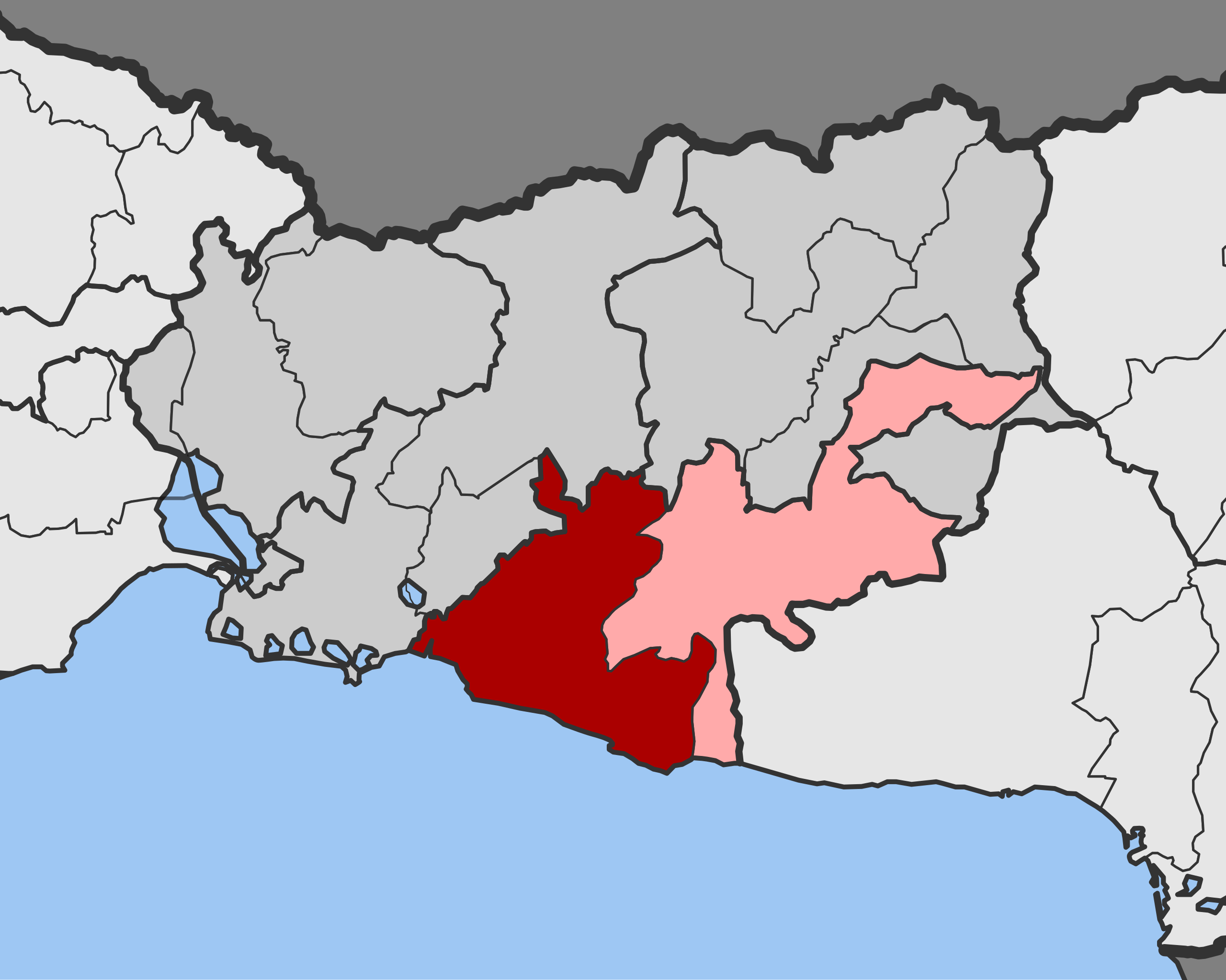
| Description | English: Position of Maronia Municipal Unit in Maronia-Sapes Municipality, Rodopi Regional Unit, East Macedonia and Thrace Region, Greece |
| Date | |
| Source | Own work |
| Author | Pitichinaccio |
Licensing
I, the copyright holder of this work, hereby publish it under the following licenses:
 | Permission is granted to copy, distribute and/or modify this document under the terms of the GNU Free Documentation License, Version 1.2 or any later version published by the Free Software Foundation; with no Invariant Sections, no Front-Cover Texts, and no Back-Cover Texts. A copy of the license is included in the section entitled GNU Free Documentation License. |
This file is licensed under the Creative Commons Attribution-Share Alike 3.0 Unported, 2.5 Generic, 2.0 Generic and 1.0 Generic license.
- You are free:
- to share – to copy, distribute and transmit the work
- to remix – to adapt the work
- Under the following conditions:
- attribution – You must give appropriate credit, provide a link to the license, and indicate if changes were made. You may do so in any reasonable manner, but not in any way that suggests the licensor endorses you or your use.
- share alike – If you remix, transform, or build upon the material, you must distribute your contributions under the same or compatible license as the original.
You may select the license of your choice.
File history
Click on a date/time to view the file as it appeared at that time.
| Date/Time | Thumbnail | Dimensions | User | Comment | |
|---|---|---|---|---|---|
| current | 12:05, 14 January 2014 | | 504 × 403 (430 KB) | Pitichinaccio | corrected boundaries according to http://geodata.gov.gr/maps/ |
| 10:39, 12 January 2014 |  | 504 × 403 (427 KB) | Pitichinaccio | == {{int:filedesc}} == {{Information |Description ={{en|1=Position of Maronia Municipal Unit in Maronia-Sapes Municipality, Rodopi Regional Unit, East Macedonia and Thrace Region, Greece}} |Source ={{own}} |Author =[[User:Pitichinacc... |
File usage
There are no pages that use this file.
Global file usage
The following other wikis use this file:
- Usage on arz.wikipedia.org
- Usage on de.wikipedia.org
- Usage on el.wikipedia.org
- Usage on en.wikipedia.org
- Usage on es.wikipedia.org
- Usage on fi.wikipedia.org
- Usage on fr.wikipedia.org
- Usage on id.wikipedia.org
- Usage on nn.wikipedia.org
- Usage on ru.wikipedia.org
- Usage on www.wikidata.org
Metadata
Explore the world

United states
New York

Japan
Tokyo

Singapore
Singapore
