
 Français
 Italiano
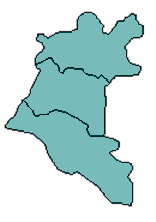
No higher resolution available.
Daraa_blank_districts.png (156 × 222 pixels, file size: 8 KB, MIME type: image/png)
This is a file from the Wikimedia Commons and may be used by other projects. Information from its description page there is shown below. Commons is a freely licensed media file repository. |
Summary
| Description | Blank map of Daraa's districts. |
| Date | |
| Source | Edited from Image:Daraa districts.png |
| Author | Anas |
Licensing
I, the copyright holder of this work, hereby publish it under the following licenses:
 | Permission is granted to copy, distribute and/or modify this document under the terms of the GNU Free Documentation License, Version 1.2 or any later version published by the Free Software Foundation; with no Invariant Sections, no Front-Cover Texts, and no Back-Cover Texts. A copy of the license is included in the section entitled GNU Free Documentation License. |
| This file is licensed under the Creative Commons Attribution-Share Alike 3.0 Unported license. | ||
| ||
| This licensing tag was added to this file as part of the GFDL licensing update. |
You may select the license of your choice.
File history
Click on a date/time to view the file as it appeared at that time.
| Date/Time | Thumbnail | Dimensions | User | Comment | |
|---|---|---|---|---|---|
| current | 12:02, 9 May 2007 | | 156 × 222 (8 KB) | Anas Salloum | {{Information |Description=Blank map of Daraa's districts. |Source=Edited from Image:Daraa districts.png |Date=May 9, 2007 |Author=Anas |Permission=I grant permission for anyone to use this under th |
File usage
There are no pages that use this file.
Global file usage
The following other wikis use this file:
- Usage on ar.wikipedia.org
- بصرى
- محافظة درعا
- درعا
- نوى
- داعل
- خربة غزالة
- الطيبة (درعا)
- كحيل
- غصم
- طفس
- جاسم
- صيدا (سوريا)
- الكرك الشرقي
- التقسيم الإداري في سوريا
- صماد (سوريا)
- عتمان
- إزرع
- دير العدس
- الغارية الغربية
- الصنمين
- المتاعية
- أبطع
- الحراك
- الغارية الشرقية
- خبب
- أنخل
- بصير
- المسمية (سوريا)
- الحارة
- الشيخ مسكين
- مستخدم:German arabic teaching sami/Syria Portal Project 01
- دير البخت
- نامر (حوران)
- جباب
- السهوة
- نصيب
- مناطق سوريا
- المسيفرة
- تل شهاب
- موثبين
- سحم الجولان
- بصر الحرير
- الطيحة
- أم ولد (درعا)
- غباغب
- تسيل (درعا)
- الشجرة (درعا)
- الجيزة (درعا)
- المزيريب
- كفر ناسج
View more global usage of this file.
Explore the world

United states
New York

Japan
Tokyo

Singapore
Singapore
