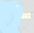
Size of this PNG preview of this SVG file: 628 × 600 pixels. Other resolutions: 251 × 240 pixels | 503 × 480 pixels | 804 × 768 pixels | 1,072 × 1,024 pixels | 2,144 × 2,048 pixels | 1,091 × 1,042 pixels.
Original file (SVG file, nominally 1,091 × 1,042 pixels, file size: 117 KB)
File history
Click on a date/time to view the file as it appeared at that time.
| Date/Time | Thumbnail | Dimensions | User | Comment | |
|---|---|---|---|---|---|
| current | 19:09, 25 November 2020 |  | 1,091 × 1,042 (117 KB) | NordNordWest | == {{int:filedesc}} == {{Information |Description= {{de|1=Positionskarte von Äquatorialguinea}} {{en|1=Location map of Equatorial Guinea}} {{Location map series N |stretching=100 |top=4.6 |bottom=-1.7 |left=5.3 |right=11.9 }} |Source={{Own using}} * United States National Imagery and Mapping Agency data * World Data Base II data |Date=2020-11-25 |Author={{U|NordNordWest}} |Permission= |other_versions= }} {{Kartenwerkstatt}} == {{int:license-header}} == {{User:NordNordWest/LicenceMap}} [[Cat... |
File usage
There are no pages that use this file.
Global file usage
The following other wikis use this file:
- Usage on af.wikipedia.org
- Usage on an.wikipedia.org
- Usage on ar.wikipedia.org
- Usage on ast.wikipedia.org
- Usage on be.wikipedia.org
- Usage on ca.wikipedia.org
- Usage on ceb.wikipedia.org
View more global usage of this file.


 Français
 Italiano


