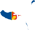
Size of this PNG preview of this SVG file: 703 × 600 pixels. Other resolutions: 282 × 240 pixels | 563 × 480 pixels | 901 × 768 pixels | 1,201 × 1,024 pixels | 2,402 × 2,048 pixels | 1,440 × 1,228 pixels.
Original file (SVG file, nominally 1,440 × 1,228 pixels, file size: 83 KB)
File history
Click on a date/time to view the file as it appeared at that time.
| Date/Time | Thumbnail | Dimensions | User | Comment | |
|---|---|---|---|---|---|
| current | 06:02, 23 March 2011 |  | 1,440 × 1,228 (83 KB) | Fry1989 | {{Information |Description=Flag map of Madeira |Source=*File:Flag-map-of-madeira.png |Date=2011-03-23 05:48 (UTC) |Author=*File:Flag-map-of-madeira.png: Erdemuygar *derivative work: ~~~~ |Permission= |other_versions= }} {{ |
File usage
There are no pages that use this file.
Global file usage
The following other wikis use this file:
- Usage on en.wikipedia.org
- Madeira Island
- São Roque do Faial
- Ponta Delgada, São Vicente
- Tabua, Madeira
- Camacha
- Caniço (Santa Cruz)
- Selvagem Grande Island
- Selvagem Pequena Island
- Deserta Grande Island
- Bugio Island
- Ilhéu Chão
- Pico do Areeiro
- Praia Formosa
- Template:Madeira-geo-stub
- Ponta do Tristão
- Ribeira Brava (parish)
- Cal Islet
- Caminho Real do Paul do Mar
- Pico das Torres
- Funchal Bay
- Ilhéu de Cima (Porto Santo)
- Santa Catarina Park
- Praia de Machico
- Praia do Porto Santo
- Pico do Facho
- Savage Islands Nature Reserve
- Usage on fi.wikipedia.org
- Usage on ru.wikipedia.org
- Usage on www.wikidata.org


 Français
 Italiano


