
 Français
 Italiano
Size of this preview: 555 × 599 pixels. Other resolutions: 222 × 240 pixels | 445 × 480 pixels | 711 × 768 pixels | 949 × 1,024 pixels | 2,000 × 2,159 pixels.
Original file (2,000 × 2,159 pixels, file size: 967 KB, MIME type: image/jpeg)
This is a file from the Wikimedia Commons and may be used by other projects. Information from its description page there is shown below. Commons is a freely licensed media file repository. |
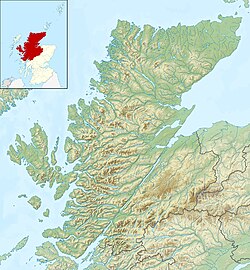
| Description | Relief map of Highland, UK. Equirectangular map projection on WGS 84 datum, with N/S stretched 180% Geographic limits:
|
| Date | |
| Source |
|
| Author | Nilfanion, created using Ordnance Survey data |
| Permission (Reusing this file) | This file is licensed under the Creative Commons Attribution-Share Alike 3.0 Unported license. Attribution: Contains Ordnance Survey data © Crown copyright and database right
|
| Other versions | File:Highland UK blank map.svg - Blank map |
File history
Click on a date/time to view the file as it appeared at that time.
| Date/Time | Thumbnail | Dimensions | User | Comment | |
|---|---|---|---|---|---|
| current | 12:22, 30 November 2011 | | 2,000 × 2,159 (967 KB) | Nilfanion | {{Information |Description=Relief map of Highland, UK. Equirectangular map projection on WGS 84 datum, with N/S stretched 180% Geographic limits: *West: 6.9W *East: 2.9W *North: 58.8N *South: 56.4N |Source=[[w:Ordnance Surv |
File usage
There are no pages that use this file.
Global file usage
The following other wikis use this file:
- Usage on ar.wikipedia.org
- Usage on arz.wikipedia.org
- Usage on ba.wikipedia.org
- Usage on bg.wikipedia.org
- Usage on ceb.wikipedia.org
- Usage on de.wikipedia.org
- Innere Hebriden
- Loch Ness
- Ben Nevis
- Eilean Donan Castle
- Urquhart Castle
- Canna
- Loch Morar
- Loch Linnhe
- Ardnamurchan
- Loch Oich
- Loch Shin
- Girnigoe and Sinclair Castle
- Dunvegan Castle
- Eilean Horrisdale
- Camus nan Geall
- Glen Coe
- Loch Lochy
- Loch Arkaig
- Loch Maree
- Ballone Castle
- Soay (Innere Hebriden)
- Ascrib Islands
- Eilean Trodday
- Wiay
- Loch Shiel
- Bealach na Bà
- Loch Assynt
- Loch Affric
- Loch Beinn a’ Mheadhoin
- Loch Cluanie
- Loch Coruisk
- Loch Dochfour
- Loch Dùghaill
- Loch an Eilean
- Loch Einich
- Loch Ericht
- Loch Loyal
- Càrn Eighe
- Cairn Gorm
- Glen Affric
- Brochel Castle
View more global usage of this file.
Explore the world

United states
New York

Japan
Tokyo

Singapore
Singapore
