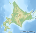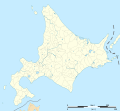
Size of this PNG preview of this SVG file: 647 × 599 pixels. Other resolutions: 259 × 240 pixels | 518 × 480 pixels | 829 × 768 pixels | 1,106 × 1,024 pixels | 2,211 × 2,048 pixels | 1,720 × 1,593 pixels.
Original file (SVG file, nominally 1,720 × 1,593 pixels, file size: 1.64 MB)
File history
Click on a date/time to view the file as it appeared at that time.
| Date/Time | Thumbnail | Dimensions | User | Comment | |
|---|---|---|---|---|---|
| current | 10:15, 3 April 2022 |  | 1,720 × 1,593 (1.64 MB) | Peka | add some lakes, change a disputed border (continuous line to dashed line) |
| 23:12, 1 July 2013 |  | 1,720 × 1,593 (1.64 MB) | Bourrichon | cours d'eau 1,5px | |
| 22:54, 1 July 2013 |  | 1,720 × 1,593 (1.64 MB) | Bourrichon | ||
| 22:42, 1 July 2013 |  | 1,720 × 1,593 (926 KB) | Bourrichon | ||
| 22:39, 1 July 2013 |  | 1,720 × 1,593 (926 KB) | Bourrichon | -bug | |
| 22:34, 1 July 2013 |  | 1,720 × 1,593 (1.55 MB) | Bourrichon | == {{int:filedesc}} == {{Location|43|00|00|N|142|00|00|E|scale:5000000}} {{Information |Description= {{fr|Carte topographique vierge de l'île de fr:Hokkaidō, au Japon, destinée à la géolocalisation.}} {{de|Topographische Karte... |
File usage
There are no pages that use this file.
Global file usage
The following other wikis use this file:
- Usage on ar.wikipedia.org
- Usage on ceb.wikipedia.org
- Usage on de.wikipedia.org
- Usu (Vulkan)
- Fernsehturm Sapporo
- Daisetsuzan-Nationalpark
- Meakan-dake
- Shiretoko-Halbinsel
- Apoi
- Tōya-See
- Mashū-See
- Rebun (Insel)
- Rishiri (Insel)
- Akan-Mashū-Nationalpark
- Okushiri (Insel)
- Saroma-See
- Shakotan-Halbinsel
- Nemuro-Straße
- Diskussion:Fernsehturm Sapporo
- Oshima-Ōshima
- Kussharo-See
- Vorlage:Positionskarte Japan Präfektur Hokkaidō
- Kamome-jima
- Yōtei-zan
- Tokachi-dake
- Burg Matsumae
- Shikotsu-Tōya-Nationalpark
- Kushiro-Shitsugen-Nationalpark
- Rishiri-Rebun-Sarobetsu-Nationalpark
- Oshima-Halbinsel
- Abashiri-Quasi-Nationalpark
- Hidaka-Sanmyaku-Erimo-Quasi-Nationalpark
- Shokanbetsu-Teuri-Yagishiri-Quasi-Nationalpark
- Niseko-Shakotan-Otaru-Kaigan-Quasi-Nationalpark
- Ōnuma-Quasi-Nationalpark
- Hagoromo-Wasserfall
- Shikotsu-See
- Eniwa (Vulkan)
- Teine (Berg)
- Makomanai-Park
- Hokkaidō-Erdbeben 2018
- Esanbe Hanakita Kojima
- Inkura-Wasserfall
- Garō-Wasserfall
- Ōdōri-Park
- Kojima (Hokkaidō)
- Rausu-dake
- Benutzer:Lupe/Baustelle/Hidaka-Sanmyaku-Erimo-Quasi-Nationalpark
- Akan (See)
- Kutcharo-See
View more global usage of this file.


 Français
 Italiano


