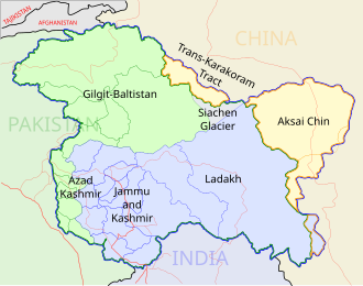
Size of this PNG preview of this SVG file: 543 × 600 pixels. Other resolutions: 217 × 240 pixels | 435 × 480 pixels | 695 × 768 pixels | 927 × 1,024 pixels | 1,855 × 2,048 pixels | 1,574 × 1,738 pixels.
Original file (SVG file, nominally 1,574 × 1,738 pixels, file size: 836 KB)
File history
Click on a date/time to view the file as it appeared at that time.
| Date/Time | Thumbnail | Dimensions | User | Comment | |
|---|---|---|---|---|---|
| current | 07:11, 29 December 2008 |  | 1,574 × 1,738 (836 KB) | Planemad | {{Information |Description= |Source= |Date= |Author= |Permission= |other_versions= }} |
| 18:12, 6 August 2006 |  | 1,639 × 1,852 (751 KB) | Planemad | {{WikiProject_India_Maps |Title=Uttar Pradesh locator map |Description=Locator map of the state of Uttar Pradesh, India with district boundaries. |Source=. |Date=August 6 2006 |Author=w:user:Nichalpw:user:Planemad |Thumbdir=CHANGE }} |
File usage
There are no pages that use this file.
Global file usage
The following other wikis use this file:
- Usage on awa.wikipedia.org
- Usage on ba.wikipedia.org
- Usage on be.wikipedia.org
- Usage on bh.wikipedia.org
- आगरा
- गाजीपुर जिला
- नजीबाबाद
- कुशीनगर
- आजमगढ़
- देवरिया जिला
- जौनपुर जिला
- गाजीपुर
- गोरखपुर
- मऊ
- पड़रौना
- सोनाडीह
- प्रयागराज जिला
- ललितपुर जिला (भारत)
- मेरठ
- भिरगू बाबा क कुटी
- सिकंदरपुर
- बैरिया
- मनियर
- नाथबाबा मंदिर
- घोसी लोकसभा चुनाव क्षेत्र
- अयोध्या जिला
- वाराणसी जिला
- अंबेडकर नगर जिला
- गाजियाबाद जिला
- राजेसुल्तानपुर
- मछलीशहर
- सुरहा ताल
- कंपनी बाग
- झूँसी
- कौशाम्बी
- चित्रकूट
- कन्नौज
- कड़ा
- दारागंज
- मुट्ठीगंज
- फूलपुर, इलाहाबाद
- नैनी
- बस्ती जिला
- फर्रूखाबाद जिला
- कन्नौज जिला
- लखनऊ जिला
- मेरठ जिला
- बाँसगाँव
- टेम्पलेट:उत्तरप्रदेश-भू-आधार
- बाँसडीह
View more global usage of this file.


 Français
 Italiano


