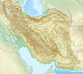
Size of this preview: 672 × 600 pixels. Other resolutions: 269 × 240 pixels | 538 × 480 pixels | 861 × 768 pixels | 1,200 × 1,071 pixels.
Original file (1,200 × 1,071 pixels, file size: 941 KB, MIME type: image/jpeg)
File history
Click on a date/time to view the file as it appeared at that time.
| Date/Time | Thumbnail | Dimensions | User | Comment | |
|---|---|---|---|---|---|
| current | 20:09, 11 July 2010 |  | 1,200 × 1,071 (941 KB) | Uwe Dedering | 31. province Alborz |
| 15:51, 23 April 2010 |  | 1,200 × 1,071 (941 KB) | Uwe Dedering | {{Information |Description={{en|1=Location map of Iran. Equirectangular projection. Strechted by 118.0%. Geographic limits of the map: * N: 40.0° N * S: 24.5° N * W: 43.5° E * E: 64.0° E Made with Natural Earth. Free vector and raster map data @ |
File usage
There are no pages that use this file.
Global file usage
The following other wikis use this file:
- Usage on als.wikipedia.org
- Usage on ar.wikipedia.org
- Usage on ary.wikipedia.org
- Usage on ast.wikipedia.org
- Usage on av.wikipedia.org
- Usage on azb.wikipedia.org
- اورمو گؤلو
- تبریز بازاری
- تهران
- سالماس
- گؤی مسجید (تبریز)
- شابلون:Location map Iran
- سهند
- دماوند
- نیشابور
- کاشمر
- سولطانیه
- زابول
- دامغان
- کیرمانشاه زلزلهسی ۱۳۹۶
- شاه عبدالعظیم توربهسی
- بلده (مازندران)
- جیرفت
- دوز گؤلو
- چغازنبیل
- قارا کیلیسا
- جندیشاپور (تاریخی شهر)
- صاحبالامر مسجیدی
- طاقبوستان
- فاطمه معصومه توربهسی
- شوشتر
- Usage on az.wikipedia.org
View more global usage of this file.


 Français
 Italiano


