
 Français
 Italiano
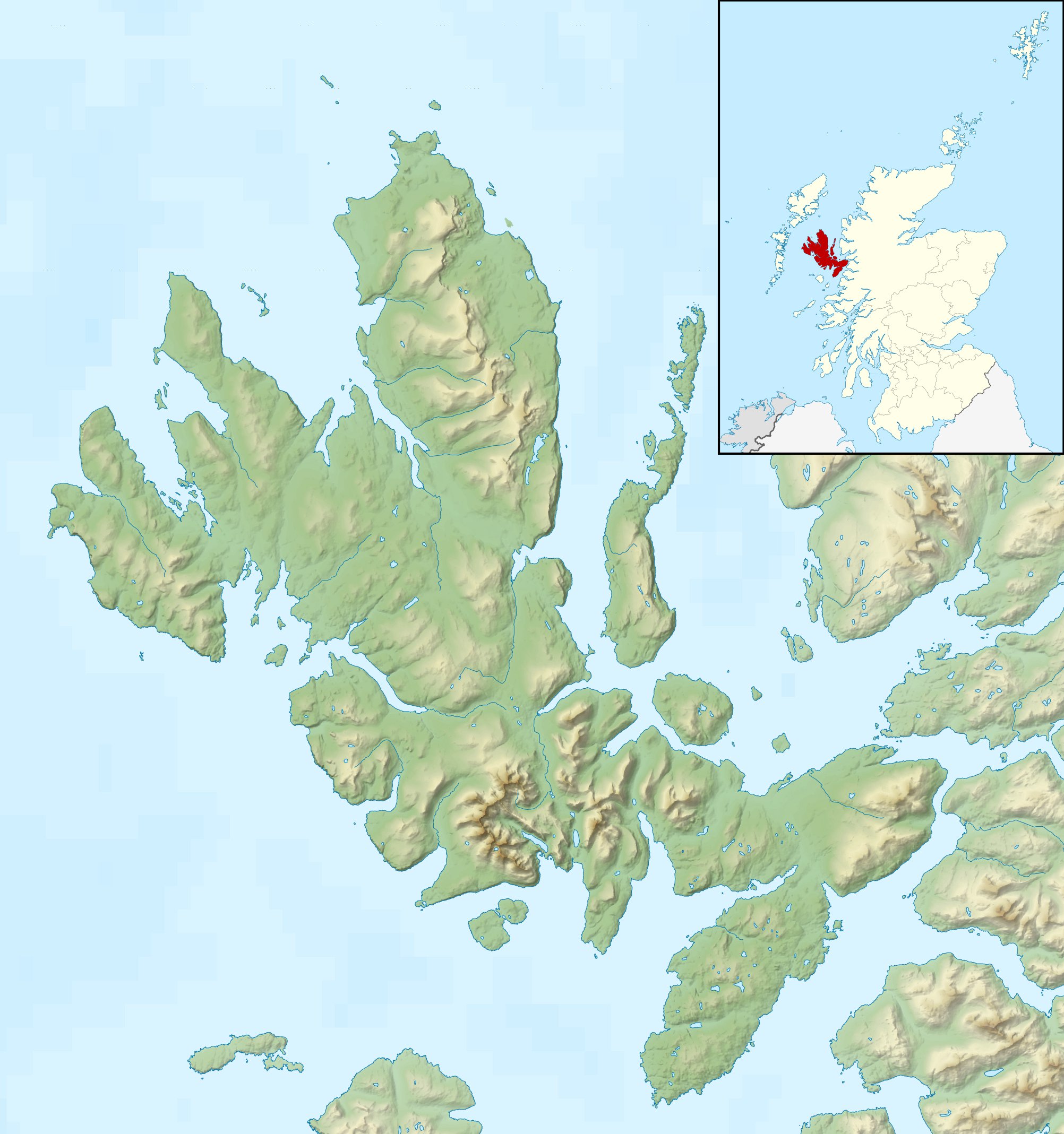
Size of this preview: 562 × 599 pixels. Other resolutions: 225 × 240 pixels | 450 × 480 pixels | 720 × 768 pixels | 960 × 1,024 pixels | 2,004 × 2,137 pixels.
Original file (2,004 × 2,137 pixels, file size: 462 KB, MIME type: image/jpeg)
This is a file from the Wikimedia Commons and may be used by other projects. Information from its description page there is shown below. Commons is a freely licensed media file repository. |
| Description | Relief map of the Isle of Skye, UK. Equirectangular map projection on WGS 84 datum, with N/S stretched 180% Geographic limits:
|
| Date | |
| Source |
|
| Author | Nilfanion, created using Ordnance Survey data |
| Permission (Reusing this file) | This file is licensed under the Creative Commons Attribution-Share Alike 3.0 Unported license. Attribution: Contains Ordnance Survey data © Crown copyright and database right
|
| Other versions | File:Isle of Skye UK blank map.svg - Blank map  |
File history
Click on a date/time to view the file as it appeared at that time.
| Date/Time | Thumbnail | Dimensions | User | Comment | |
|---|---|---|---|---|---|
| current | 00:28, 17 December 2011 | | 2,004 × 2,137 (462 KB) | Nilfanion | {{Information |Description=Relief map of the Isle of Skye, UK. Equirectangular map projection on WGS 84 datum, with N/S stretched 180% Geographic limits: *West: 6.85W *East: 5.5W *North: 57.8N *South: 57.0N |Source=[[w:Ordnance Survey |
File usage
There are no pages that use this file.
Global file usage
The following other wikis use this file:
- Usage on ar.wikipedia.org
- Usage on ceb.wikipedia.org
- Usage on cs.wikipedia.org
- Usage on da.wikipedia.org
- Usage on de.wikipedia.org
- Usage on en.wikipedia.org
- Soay, Inner Hebrides
- Sorley MacLean
- Raasay
- South Rona
- Scalpay, Inner Hebrides
- Sgùrr Alasdair
- Blà Bheinn
- Wiay, Inner Hebrides
- Eilean Bàn
- Am Basteir
- Bruach na Frìthe
- Sgùrr a' Ghreadaidh
- Sgùrr a' Mhadaidh
- Pabay
- Ornsay
- Beinn na Caillich (Red Hills)
- Eilean Mòr, Crowlin Islands
- Loch Snizort
- Isle of Skye
- South Ascrib
- Harlosh Island
- Tarner Island
- Eilean Tigh
- Eilean Mòr, Loch Dunvegan
- Staffin Island
- Module:Location map/data/Scotland Isle of Skye/doc
- Beinn na Caillich (Kyle Rhea)
- Eilean Meadhonach
- High Pasture Cave
- Portal:Islands/Selected article
- Module:Location map/data/Scotland Isle of Skye
View more global usage of this file.
Explore the world

United states
New York

Japan
Tokyo

Singapore
Singapore
