
 Français
 Italiano
Size of this PNG preview of this SVG file: 361 × 599 pixels. Other resolutions: 145 × 240 pixels | 289 × 480 pixels | 463 × 768 pixels | 617 × 1,024 pixels | 1,235 × 2,048 pixels | 1,720 × 2,852 pixels.
Original file (SVG file, nominally 1,720 × 2,852 pixels, file size: 3.31 MB)
This is a file from the Wikimedia Commons and may be used by other projects. Information from its description page there is shown below. Commons is a freely licensed media file repository. |
Summary
| Camera location | | View this and other nearby images on: OpenStreetMap |
|---|
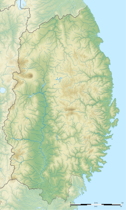
| Description | Français : Carte topographique vierge de la Préfecture d'Iwate, au Japon, destinée à la géolocalisation. Deutsch: Topographische Karte der Präfektur Iwate. English: Topographic blank map of the Iwate Prefecture, for geolocalisation purpose. Español: Mapa topográfico de la Prefectura de Iwate. Italiano: Mappa topografica della Prefettura di Iwate. 日本語: 岩手県の地図. Português: Carta topográfica de la província de Iwate.
| ||
| Date | (UTC) | ||
| Source | Création personnelle ;
| ||
| Author | © Bourrichon (talk) - fr:Bourrichon | ||
| Permission (Reusing this file) |
| ||
| Other versions | File:Iwate-ken géolocalisation.svg |
| This SVG file contains embedded text that can be translated into your language, using any capable SVG editor, text editor or the SVG Translate tool. For more information see: About translating SVG files. |
This W3C-unspecified vector image was created with Inkscape .
Licensing
I, the copyright holder of this work, hereby publish it under the following license:
This file is licensed under the Creative Commons Attribution-Share Alike 2.0 France license.
Attribution: Bourrichon (atelier graphique)
- You are free:
- to share – to copy, distribute and transmit the work
- to remix – to adapt the work
- Under the following conditions:
- attribution – You must give appropriate credit, provide a link to the license, and indicate if changes were made. You may do so in any reasonable manner, but not in any way that suggests the licensor endorses you or your use.
- share alike – If you remix, transform, or build upon the material, you must distribute your contributions under the same or compatible license as the original.

File history
Click on a date/time to view the file as it appeared at that time.
| Date/Time | Thumbnail | Dimensions | User | Comment | |
|---|---|---|---|---|---|
| current | 21:32, 3 July 2013 | | 1,720 × 2,852 (3.31 MB) | Bourrichon | |
| 21:27, 3 July 2013 |  | 1,720 × 2,852 (2.96 MB) | Bourrichon | == {{int:filedesc}} == {{Location|39|00|00|N|141|00|00|E|scale:10000}} {{Information |Description= {{fr|Carte topographique vierge de la fr:Préfecture d'Iwate, au Japon, destinée à la géolocalisation.}} {{de|Topographische Kart... |
File usage
There are no pages that use this file.
Global file usage
The following other wikis use this file:
- Usage on ar.wikipedia.org
- Usage on ceb.wikipedia.org
- Usage on ce.wikipedia.org
- Usage on de.wikipedia.org
- Usage on en.wikipedia.org
- Iwate Morioka Stadium
- Battle of Miyako Bay
- Battle of Kawasaki
- Morioka Castle
- Mōtsū-ji
- Kanjizaiō-in
- Chūson-ji
- Nakatsu River
- Mount Hayachine
- Sarugaishi River
- Waga River
- Ishibuchi Dam
- Mount Iwate
- Goishi Coast
- Scenic areas of Ihatov
- Genbikei
- Jōdogahama
- Geibikei
- Hayachine Quasi-National Park
- Ryūsendō
- Module:Location map/data/Japan Iwate Prefecture/doc
- Yuda Onsenkyō Prefectural Natural Park
- Fudō Falls
- Akkadō
- Goshono site
- Kunohe Castle
- Shiwa Castle
- Tokutan Castle
- Cape Todo
- Sakiyama Shell Mound
- Ayaorishinden Site
- Kabayama Site
- Hatten Site
- Ezuriko Kofun Cluster
- Hashino iron mining and smelting site
- Nanbu-Date border mounds
- Nakazawahama Shell Mound
View more global usage of this file.
Metadata
Explore the world

United states
New York

Japan
Tokyo

Singapore
Singapore
