
 Français
 Italiano
Size of this PNG preview of this SVG file: 535 × 600 pixels. Other resolutions: 214 × 240 pixels | 428 × 480 pixels | 685 × 768 pixels | 914 × 1,024 pixels | 1,827 × 2,048 pixels | 2,343 × 2,626 pixels.
Original file (SVG file, nominally 2,343 × 2,626 pixels, file size: 1.6 MB)
This is a file from the Wikimedia Commons and may be used by other projects. Information from its description page there is shown below. Commons is a freely licensed media file repository. |
_-_OSM_Mapnik.svg)
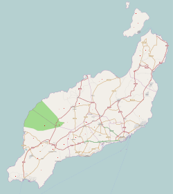
| Description | This map was created from OpenStreetMap project data, collected by the community. This map may be incomplete, and may contain errors. Don't rely solely on it for navigation. | |||
| Date | (see file history) | |||
| Source | http://www.openstreetmap.org/?lat=29.066&lon=-13.633&zoom=10&layers=B000FTFTT | |||
| Creator | OpenStreetMap contributors | |||
| Permission (Reusing this file) | OpenStreetMap data is available under the Open Database License (details). Map tiles are licensed under the Creative Commons Attribution-ShareAlike 2.0 license (CC-BY-SA 2.0).
This file is licensed under the Creative Commons Attribution-Share Alike 2.0 Generic license.
| |||
| Georeferencing | If inappropriate please set warp_status = skip to hide. |
File history
Click on a date/time to view the file as it appeared at that time.
| Date/Time | Thumbnail | Dimensions | User | Comment | |
|---|---|---|---|---|---|
| current | 13:48, 25 November 2010 | | 2,343 × 2,626 (1.6 MB) | Muro de Aguas | updating |
| 14:24, 2 July 2010 |  | 2,343 × 2,626 (1.41 MB) | Muro de Aguas | updating | |
| 17:22, 16 April 2010 |  | 2,343 × 2,626 (1.4 MB) | Muro de Aguas | updating | |
| 17:21, 27 February 2010 |  | 2,343 × 2,626 (1.34 MB) | Muro de Aguas | {{OpenStreetMap|name=Lanzarote|source=http://www.openstreetmap.org/?lat=29.066&lon=-13.633&zoom=10&layers=B000FTFTT}} Category:OpenStreetMap maps of the Canary Islands Category:Maps of Lanzarote Category:Maps of the Canary Islands |
File usage
There are no pages that use this file.
Global file usage
The following other wikis use this file:
- Usage on ar.wikipedia.org
- Usage on ast.wikipedia.org
- Usage on da.wikipedia.org
- Usage on en.wikipedia.org
- Lanzarote
- Arrecife
- Puerto del Carmen
- Lanzarote Airport
- Graciosa, Canary Islands
- Montaña Clara
- Teguise (municipality)
- Teguise (village)
- Guatiza
- Timanfaya National Park
- Costa Teguise
- Órzola
- Caleta de Sebo
- Arrieta, Lanzarote
- Playa Blanca
- Casas de Pedro Barba
- Charco del Palo
- Tahíche
- Module:Location map/data/Spain Lanzarote
- Castillo de San José
- Module:Location map/data/Spain Lanzarote/doc
- Template:Lighthouses of the Canary Islands map
- Famara
- Strait of El Río
- User:Shazertom/La Graciosa
- Usage on eo.wikipedia.org
- Usage on es.wikipedia.org
View more global usage of this file.
_-_OSM_Mapnik.svg)
_-_OSM_Mapnik.svg)
Explore the world

United states
New York

Japan
Tokyo

Singapore
Singapore
