
 Français
 Italiano
Size of this PNG preview of this SVG file: 499 × 600 pixels. Other resolutions: 200 × 240 pixels | 399 × 480 pixels | 639 × 768 pixels | 852 × 1,024 pixels | 1,704 × 2,048 pixels | 1,086 × 1,305 pixels.
Original file (SVG file, nominally 1,086 × 1,305 pixels, file size: 2.71 MB)
This is a file from the Wikimedia Commons and may be used by other projects. Information from its description page there is shown below. Commons is a freely licensed media file repository. |
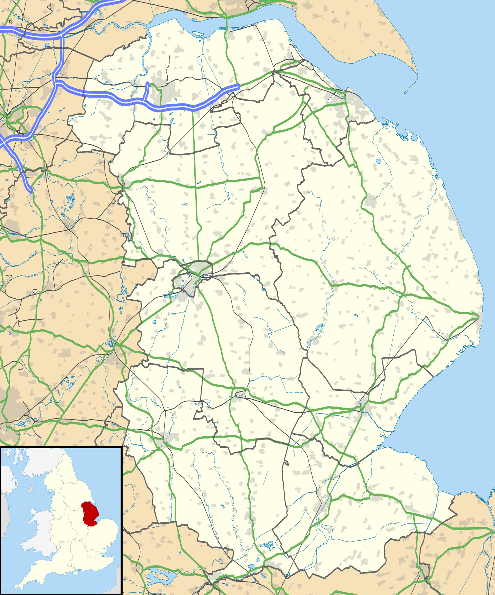
| Description | Map of Lincolnshire, UK with the following information shown:
Equirectangular map projection on WGS 84 datum, with N/S stretched 165% Geographic limits:
|
| Date | 2010-07-17 |
| Source |
|
| Author | Nilfanion, created using Ordnance Survey data |
| Permission (Reusing this file) | This file is licensed under the Creative Commons Attribution-Share Alike 3.0 Unported license. Attribution: Contains Ordnance Survey data © Crown copyright and database right
|
| Other versions | File:Lincolnshire UK district map (blank).svg - Blank map |
.svg)
File history
Click on a date/time to view the file as it appeared at that time.
| Date/Time | Thumbnail | Dimensions | User | Comment | |
|---|---|---|---|---|---|
| current | 19:01, 26 September 2010 | | 1,086 × 1,305 (2.71 MB) | Nilfanion | {{Information |Description=Map of Lincolnshire, UK with the following information shown: *Administrative borders *Coastline, lakes and rivers *Roads and railways *Urban areas Equirectangular map projection on WGS 84 datum, with N/S str |
File usage
There are no pages that use this file.
Global file usage
The following other wikis use this file:
- Usage on ar.wikipedia.org
- Usage on azb.wikipedia.org
- Usage on bg.wikipedia.org
- Usage on ceb.wikipedia.org
- Usage on de.wikipedia.org
- Usage on el.wikipedia.org
- Usage on en.wikipedia.org
- Sausthorpe
- Boston, Lincolnshire
- Crowland
- Woolsthorpe Manor
- Sutton Bridge
- Grantham
- Harlaxton Manor
- Brigg
- Cleethorpes
- Sleaford
- Woolsthorpe-by-Colsterworth
- Bolingbroke, Lincolnshire
- Scopwick
- North Thoresby
- Read's Island
- Grimsby
- Cranwell
- Scunthorpe
- Whitton, Lincolnshire
- Woolsthorpe by Belvoir
- Swallow, Lincolnshire
- Saltfleet
- Skegness
- Epworth, Lincolnshire
- Gainsborough, Lincolnshire
- Barton-upon-Humber
- Spalding, Lincolnshire
- Horncastle
- Louth, Lincolnshire
- Bourne, Lincolnshire
- Stamford, Lincolnshire
- Haddington, Lincolnshire
- Alford, Lincolnshire
- Crowle, Lincolnshire
- Market Rasen
- RAF Waddington
- Scartho
- RAF Scampton
- RAF Digby
- South Ormsby
- Salmonby
- Tathwell
- Ancaster, Lincolnshire
- RAF Coningsby
View more global usage of this file.
Metadata
Explore the world

United states
New York

Japan
Tokyo

Singapore
Singapore
