
 Français
 Italiano
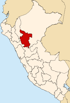
No higher resolution available.
Location_of_San_Martin_Region.png (236 × 344 pixels, file size: 29 KB, MIME type: image/png)
This is a file from the Wikimedia Commons and may be used by other projects. Information from its description page there is shown below. Commons is a freely licensed media file repository. |
 | File:Peru - San Martín Department (locator map).svg is a vector version of this file. It should be used in place of this PNG file when not inferior. File:Location of San Martin Region.png → File:Peru - San Martín Department (locator map).svg For more information, see Help:SVG. | .svg) |
Summary
| Description | made by en:User:StarbucksFreak |
| Date | 20 December 2005 (original upload date) |
| Source | Transferred from en.wikipedia to Commons. |
| Author | StarbucksFreak at English Wikipedia |
Licensing
StarbucksFreak at the English-language Wikipedia, the copyright holder of this work, hereby publishes it under the following license:
| This file is licensed under the Creative Commons Attribution-Share Alike 3.0 Unported license. Subject to disclaimers. | ||
| Attribution: StarbucksFreak at the English-language Wikipedia | ||
| ||
| This licensing tag was added to this file as part of the GFDL licensing update. |
 | Permission is granted to copy, distribute and/or modify this document under the terms of the GNU Free Documentation License, Version 1.2 or any later version published by the Free Software Foundation; with no Invariant Sections, no Front-Cover Texts, and no Back-Cover Texts. A copy of the license is included in the section entitled GNU Free Documentation License. Subject to disclaimers. |
Original upload log
The original description page was here. All following user names refer to en.wikipedia.
- 2005-12-20 20:04 StarbucksFreak 236×344×8 (29866 bytes) made by [[User:StarbucksFreak]]
Licensing
| | Permission is granted to copy, distribute and/or modify this document under the terms of the GNU Free Documentation License, Version 1.2 or any later version published by the Free Software Foundation; with no Invariant Sections, no Front-Cover Texts, and no Back-Cover Texts. A copy of the license is included in the section entitled GNU Free Documentation License. Subject to disclaimers. |
File history
Click on a date/time to view the file as it appeared at that time.
| Date/Time | Thumbnail | Dimensions | User | Comment | |
|---|---|---|---|---|---|
| current | 19:41, 9 August 2007 | | 236 × 344 (29 KB) | AgainErick | {{Information |Description=made by en:User:StarbucksFreak |Source=Originally from [http://en.wikipedia.org en.wikipedia]; description page is/was [http://en.wikipedia.org/w/index.php?title=Image%3ALocation_of_San_Martin_Region.png here]. |Date=2005-1 |
File usage
There are no pages that use this file.
Global file usage
The following other wikis use this file:
- Usage on ba.wikipedia.org
- Usage on en.wikipedia.org
- Moyobamba province
- San Martín province
- Huallaga province
- Rioja, Peru
- Rioja province, Peru
- Lamas province
- Lamas, Peru
- Mariscal Cáceres National Forest
- Rioja District
- Bellavista province
- El Dorado province
- Picota province
- Mariscal Cáceres province
- Alto Biavo District
- Bajo Biavo District
- Bellavista District, Bellavista
- Huallaga District
- San Pablo District, Bellavista
- San Rafael District, Bellavista
- Agua Blanca District
- San José de Sisa District
- San Martín District
- Santa Rosa District, El Dorado
- Shatoja District
- Buenos Aires District, Picota
- Caspisapa District
- Picota District
- Pilluana District
- Pucacaca District
- San Cristóbal District, Picota
- San Hilarion District
- Shamboyacu District
- Tingo de Ponasa District
- Tres Unidos District
- Alberto Leveau District
- Cacatachi District
- Chazuta District
- Chipurana District
- El Porvenir District, San Martín
- Huimbayoc District
- Juan Guerra District
- La Banda de Shilcayo District
- Papaplaya District
- San Antonio District, San Martín
- Sauce District
- Shapaja District
- Tarapoto District
- Morales District
- Alonso de Alvarado District
View more global usage of this file.
Explore the world

United states
New York

Japan
Tokyo

Singapore
Singapore
