
 Français
 Italiano
Size of this PNG preview of this SVG file: 512 × 343 pixels. Other resolutions: 320 × 214 pixels | 640 × 429 pixels | 1,024 × 686 pixels | 1,280 × 858 pixels | 2,560 × 1,715 pixels.
Original file (SVG file, nominally 512 × 343 pixels, file size: 308 KB)
This is a file from the Wikimedia Commons and may be used by other projects. Information from its description page there is shown below. Commons is a freely licensed media file repository. |
Summary
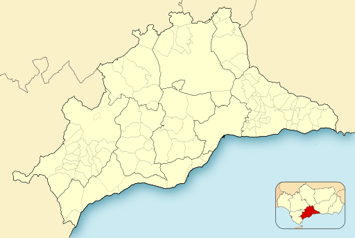
| Description | English: Location map of Málaga Equirectangular projection, N/S stretching 130 %. Geographic limits of the map:
Español: Mapa de localización de Málaga Proyección equirrectangular, N/S estirada 130 %. Límites geográficos del mapa:
| |
| Date | ||
| Source | Own work based on: Spain location map.svg by HansenBCN | |
| Author | Miguillen | |
| SVG development | This locator map was created with Inkscape.
|
Licensing
I, the copyright holder of this work, hereby publish it under the following licenses:
 | Permission is granted to copy, distribute and/or modify this document under the terms of the GNU Free Documentation License, Version 1.2 or any later version published by the Free Software Foundation; with no Invariant Sections, no Front-Cover Texts, and no Back-Cover Texts. A copy of the license is included in the section entitled GNU Free Documentation License. |
This file is licensed under the Creative Commons Attribution-Share Alike 4.0 International, 3.0 Unported, 2.5 Generic, 2.0 Generic and 1.0 Generic license.
- You are free:
- to share – to copy, distribute and transmit the work
- to remix – to adapt the work
- Under the following conditions:
- attribution – You must give appropriate credit, provide a link to the license, and indicate if changes were made. You may do so in any reasonable manner, but not in any way that suggests the licensor endorses you or your use.
- share alike – If you remix, transform, or build upon the material, you must distribute your contributions under the same or compatible license as the original.
You may select the license of your choice.
File history
Click on a date/time to view the file as it appeared at that time.
| Date/Time | Thumbnail | Dimensions | User | Comment | |
|---|---|---|---|---|---|
| current | 15:15, 9 December 2010 | | 512 × 343 (308 KB) | Miguillen | colores y mosca según convención |
| 22:02, 16 April 2010 |  | 512 × 343 (208 KB) | Miguillen | sombreado | |
| 21:57, 16 April 2010 |  | 512 × 343 (208 KB) | Miguillen | arreglo fallos | |
| 20:27, 16 April 2010 |  | 512 × 343 (209 KB) | Tyk | 2 small details | |
| 16:00, 16 April 2010 |  | 512 × 343 (208 KB) | Miguillen | {{Information |Description=Mapa de laprovincia de Málaga dividido en municipios y comarcas |Source={{own}} |Date=2010-04-16 |Author=Miguillen |Permission= |other_versions= }} Category:Maps of Málaga |
File usage
There are no pages that use this file.
Global file usage
The following other wikis use this file:
- Usage on ar.wikipedia.org
- Usage on azb.wikipedia.org
- Usage on ba.wikipedia.org
- Usage on ceb.wikipedia.org
- Usage on cs.wikipedia.org
- Usage on cv.wikipedia.org
- Usage on de.wikipedia.org
- Dolmen von Menga
- Estadio La Rosaleda
- Flughafen Málaga
- Castillo de Sohail
- Wikipedia:Kartenwerkstatt/Positionskarten/Europa
- Castillo de Gibralfaro
- La Maroma
- Vorlage:Positionskarte Spanien Málaga
- Palacio de Deportes José María Martín Carpena
- Tholos von El Romeral
- Dolmen de Viera
- Embalse de la Concepción
- Embalse de El Limonero
- Aeródromo de La Axarquía
- Torre Ladrones
- Puente de los Alemanes
- Höhlen von Nerja
- Torrecilla (Berg)
- Usage on en.wikipedia.org
View more global usage of this file.
Metadata
Explore the world

United states
New York

Japan
Tokyo

Singapore
Singapore
