
 Français
 Italiano
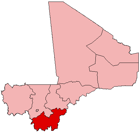
No higher resolution available.
Mali_Sikasso.png (449 × 443 pixels, file size: 5 KB, MIME type: image/png)
This is a file from the Wikimedia Commons and may be used by other projects. Information from its description page there is shown below. Commons is a freely licensed media file repository. |
Summary
| Description | English: Map of Mali showing Sikasso Region; created with the GIMP. Made by User:Acntx. |
| Date | 31 July 2005 (original upload date) |
| Source | Own work |
| Author | Acntx at English Wikipedia |
Licensing
Acntx at English Wikipedia, the copyright holder of this work, hereby publishes it under the following license:
| This file is licensed under the Creative Commons Attribution-Share Alike 3.0 Unported license. Subject to disclaimers. | ||
| Attribution: Acntx at English Wikipedia | ||
| ||
| This licensing tag was added to this file as part of the GFDL licensing update. |
 | Permission is granted to copy, distribute and/or modify this document under the terms of the GNU Free Documentation License, Version 1.2 or any later version published by the Free Software Foundation; with no Invariant Sections, no Front-Cover Texts, and no Back-Cover Texts. A copy of the license is included in the section entitled GNU Free Documentation License. Subject to disclaimers. |
Original upload log
The original description page was here. All following user names refer to en.wikipedia.
- 2005-07-31 21:24 Acntx 449×443 (5321 bytes)
File history
Click on a date/time to view the file as it appeared at that time.
| Date/Time | Thumbnail | Dimensions | User | Comment | |
|---|---|---|---|---|---|
| current | 19:52, 12 July 2012 | | 449 × 443 (5 KB) | MGA73bot2 | {{BotMoveToCommons|en.wikipedia|year={{subst:CURRENTYEAR}}|month={{subst:CURRENTMONTHNAME}}|day={{subst:CURRENTDAY}}}} == {{int:filedesc}} == {{Information |description={{en|1=Map of Mali showing Sikasso Region; created with the GIMP. Made by [[:en:Us... |
File usage
There are no pages that use this file.
Global file usage
The following other wikis use this file:
- Usage on ceb.wikipedia.org
- Usage on en.wikipedia.org
- Sikasso Region
- Sikasso
- Yanfolila
- Koutiala
- Bougouni
- Niéna
- Koumantou
- Yorosso
- Mount Tenakourou
- Bougouni Airport
- Sikasso Airport
- Wikipedia:WikiProject Mali/Regional commune templates
- Template:Communes of the Sikasso Region
- Bougouni Cercle
- Kolondieba Cercle
- Kadiolo Cercle
- Koutiala Cercle
- Sikasso Cercle
- Yanfolila Cercle
- Yorosso Cercle
- Template:Sikasso-geo-stub
- Miria, Mali
- Zantiébougou
- Yinindougou
- Garalo
- Defina
- Bladié-Tiémala
- Sanso
- Domba, Mali
- Wola, Mali
- Debelin
- Keleya
- Meridiela
- Dogo, Sikasso
- Syen Toula
- Ouroun
- Faragouaran
- Sido, Mali
- Kokele
- Faradiele
- Kolondieba
- Bougoula, Sikasso
- Fakola
- Farako, Sikasso
- Nangalasso
- Tiongui
- Kadiana
- Kebila
- Tousseguela
View more global usage of this file.
Metadata
Explore the world

United states
New York

Japan
Tokyo

Singapore
Singapore
