
 Français
 Italiano
Size of this PNG preview of this SVG file: 428 × 599 pixels. Other resolutions: 171 × 240 pixels | 343 × 480 pixels | 549 × 768 pixels | 732 × 1,024 pixels | 1,464 × 2,048 pixels | 8,488 × 11,872 pixels.
Original file (SVG file, nominally 8,488 × 11,872 pixels, file size: 1.01 MB)
This is a file from the Wikimedia Commons and may be used by other projects. Information from its description page there is shown below. Commons is a freely licensed media file repository. |
.svg)
Summary
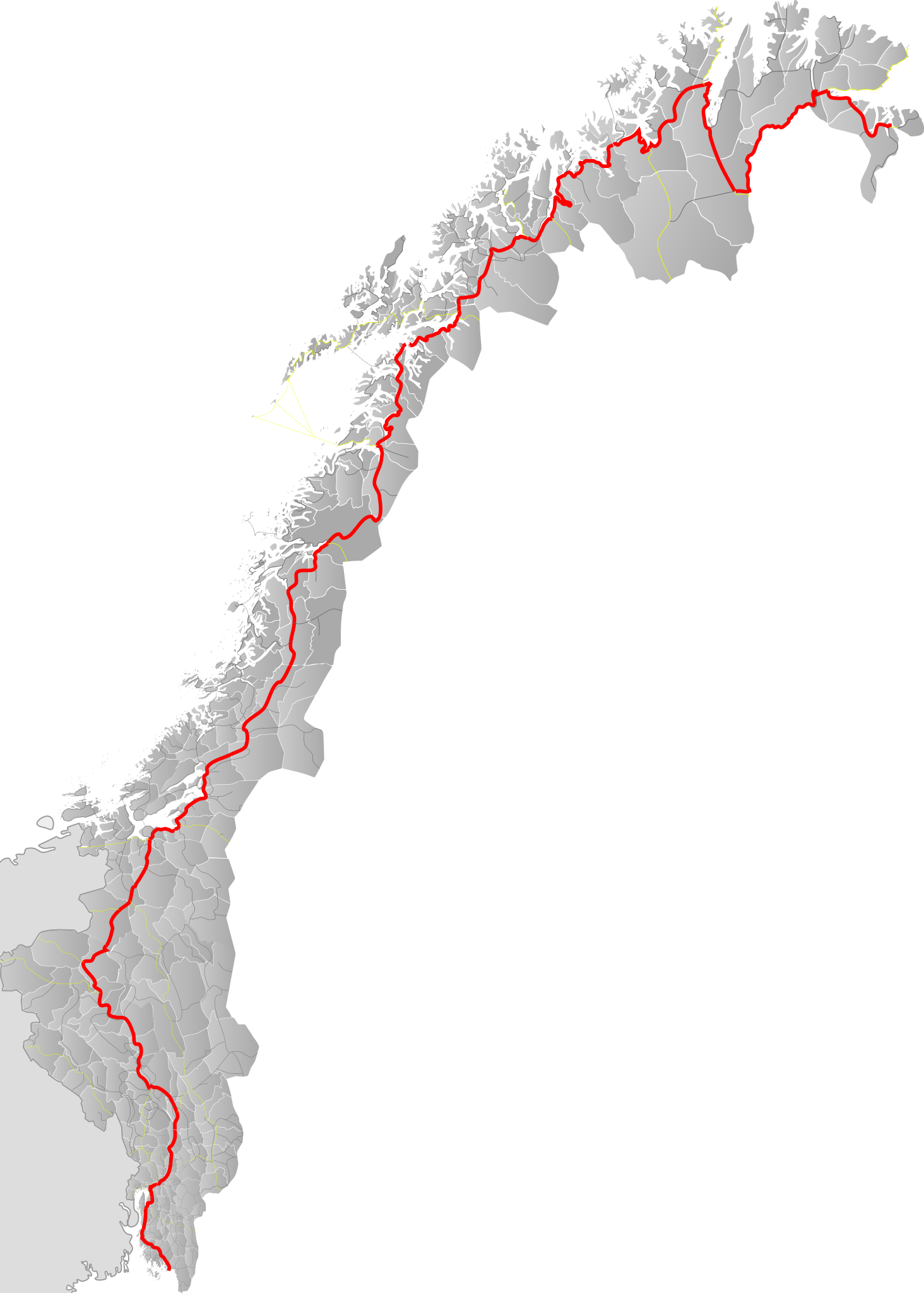
| Description | English: Map of norwegian trunk road E6 |
| Date | |
| Source | Own work by uploader, based on county base locator maps |
| Author | BjørnN |
Licensing
| I, the copyright holder of this work, release this work into the public domain. This applies worldwide. In some countries this may not be legally possible; if so: I grant anyone the right to use this work for any purpose, without any conditions, unless such conditions are required by law. |
File history
Click on a date/time to view the file as it appeared at that time.
| Date/Time | Thumbnail | Dimensions | User | Comment | |
|---|---|---|---|---|---|
| current | 07:28, 25 July 2020 | | 8,488 × 11,872 (1.01 MB) | BjørnN | Hålogalandsbrua included |
| 21:50, 2 June 2009 |  | 8,488 × 11,872 (1.27 MB) | BjørnN | Filled contours | |
| 21:24, 2 June 2009 |  | 8,488 × 11,872 (1.34 MB) | BjørnN | Contours added | |
| 20:12, 2 June 2009 |  | 8,488 × 11,872 (1.29 MB) | BjørnN | {{Information |Description={{en|1=Map of norwegian trunk road E6}} |Source=Own work by uploader, based on county base locator maps |Author=BjørnN |Date=2009-06-02 |Permission= |other_versions= }} <!--{{ImageUpload|full}}--> [[Category:R |
File usage
The following 3 pages use this file:
Global file usage
The following other wikis use this file:
- Usage on it.wikivoyage.org
- Usage on nn.wikipedia.org
- Usage on no.wikipedia.org
- Usage on pl.wikivoyage.org
Metadata
.svg)
Explore the world

United states
New York

Japan
Tokyo

Singapore
Singapore
