
 Français
 Italiano
Size of this PNG preview of this SVG file: 612 × 600 pixels. Other resolutions: 245 × 240 pixels | 490 × 480 pixels | 784 × 768 pixels | 1,045 × 1,024 pixels | 2,090 × 2,048 pixels | 2,511 × 2,461 pixels.
Original file (SVG file, nominally 2,511 × 2,461 pixels, file size: 2.49 MB)
This is a file from the Wikimedia Commons and may be used by other projects. Information from its description page there is shown below. Commons is a freely licensed media file repository. |
W3C-validity not checked.
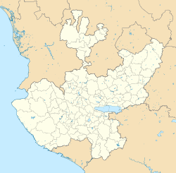
| Description | Location Map of Jalisco. EPSG:3857 projection, Geographic limits of the map:
|
| Date | |
| Source |
|
| Author | Battroid (talk) |
I, the copyright holder of this work, hereby publish it under the following license:
| I, the copyright holder of this work, release this work into the public domain. This applies worldwide. In some countries this may not be legally possible; if so: I grant anyone the right to use this work for any purpose, without any conditions, unless such conditions are required by law. |
File history
Click on a date/time to view the file as it appeared at that time.
| Date/Time | Thumbnail | Dimensions | User | Comment | |
|---|---|---|---|---|---|
| current | 21:02, 26 April 2015 | | 2,511 × 2,461 (2.49 MB) | Addicted04 | Fix |
| 20:46, 26 April 2015 |  | 2,511 × 2,461 (2.49 MB) | Addicted04 | New map (INEGI, 2014) | |
| 04:37, 30 September 2011 |  | 2,618 × 2,502 (446 KB) | Battroid | {{ValidSVG}} {{Information |Description=Location Map of Jalisco Equirectangular projection, Geographic limits of the map: * N: 22.92° N * S: 18.58° N * W: 106.08° W * E: 101.29° W |Source={{own work}} |Date=2011-09-29 |Author=[[User:Ba |
File usage
There are no pages that use this file.
Global file usage
The following other wikis use this file:
- Usage on ar.wikipedia.org
- Usage on ba.wikipedia.org
- Usage on bg.wikipedia.org
- Usage on ceb.wikipedia.org
- Usage on ce.wikipedia.org
- Usage on de.wikipedia.org
- Puerto Vallarta
- Guadalajara (Mexiko)
- Chapalasee
- Colima (Vulkan)
- Tuxpan (Jalisco)
- Zapopan
- Tequila (Jalisco)
- Atenquique
- Ciudad Guzmán
- Nationalpark Nevado de Colima
- Mazamitla
- Cocula
- Totatiche
- Estadio Jalisco
- San Juan de los Lagos
- Wikipedia:Kartenwerkstatt/Positionskarten/Nordamerika
- Torrena
- Estadio Tres de Marzo
- Tlaquepaque
- Estadio Akron
- Chapala
- Ocotlán
- Vorlage:Positionskarte Mexiko Jalisco
- Barra de Navidad
- Bosque de la Primavera
- Ajijic
- Ameca (Jalisco)
- Velódromo Panamericano
- Puente Grande
- Tapalpa
- Guadalajara-Kartell
- Ojuelos de Jalisco
- Lagos de Moreno
- Encarnación de Díaz
- San Sebastián del Oeste
- Talpa de Allende
- Tonalá (Jalisco)
- Bolaños (Jalisco)
View more global usage of this file.
Metadata
Explore the world

United states
New York

Japan
Tokyo

Singapore
Singapore
