
 Français
 Italiano
Size of this PNG preview of this SVG file: 489 × 600 pixels. Other resolutions: 196 × 240 pixels | 391 × 480 pixels | 626 × 768 pixels | 835 × 1,024 pixels | 1,670 × 2,048 pixels | 2,043 × 2,506 pixels.
Original file (SVG file, nominally 2,043 × 2,506 pixels, file size: 1.87 MB)
This is a file from the Wikimedia Commons and may be used by other projects. Information from its description page there is shown below. Commons is a freely licensed media file repository. |
W3C-validity not checked.
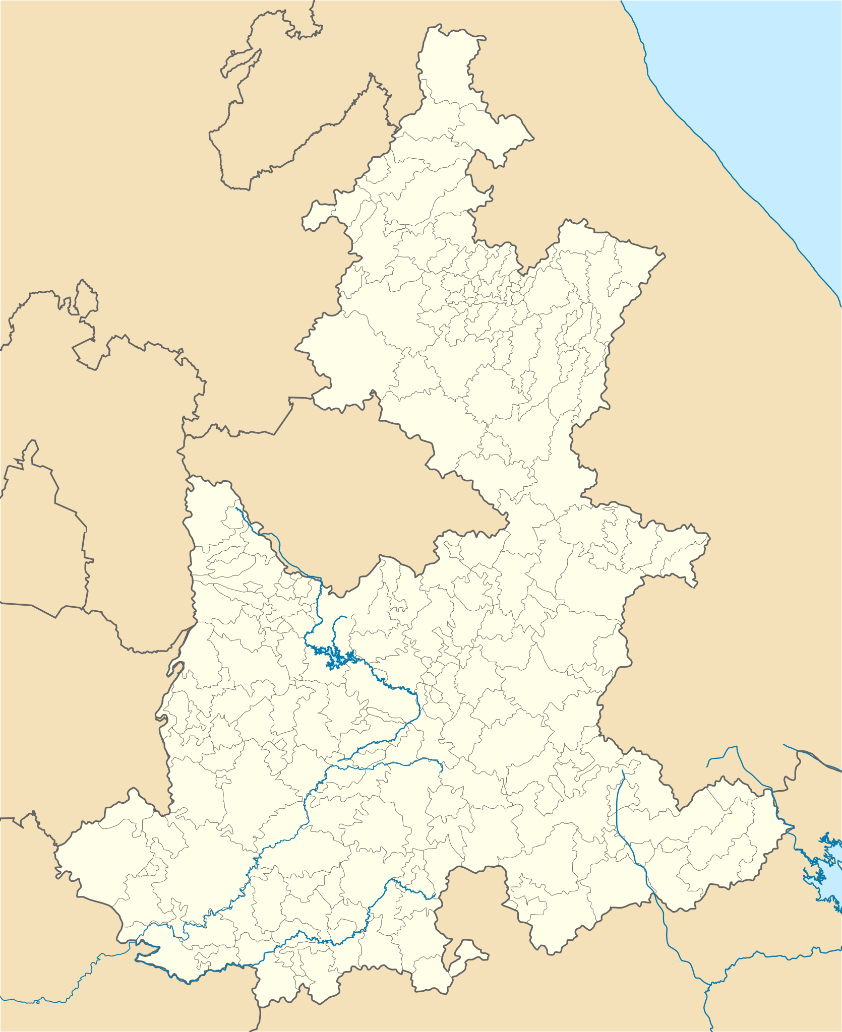
| Description | Location Map of Puebla Equirectangular projection, Geographic limits of the map:
|
| Date | |
| Source | Own work |
| Author | Battroid (talk) |
I, the copyright holder of this work, hereby publish it under the following license:
| I, the copyright holder of this work, release this work into the public domain. This applies worldwide. In some countries this may not be legally possible; if so: I grant anyone the right to use this work for any purpose, without any conditions, unless such conditions are required by law. |
File history
Click on a date/time to view the file as it appeared at that time.
| Date/Time | Thumbnail | Dimensions | User | Comment | |
|---|---|---|---|---|---|
| current | 06:25, 23 April 2012 | | 2,043 × 2,506 (1.87 MB) | Battroid | {{ValidSVG}} {{Information |Description=Location Map of Puebla Equirectangular projection, Geographic limits of the map: * N: 20.9° N * S: 17.8° N * W: 99.25° W * E: 96.57° W |Source={{own work}} |Date=2012-04-23 |Author=[[User:Battr... |
| 06:18, 23 April 2012 |  | 2,043 × 2,506 (1.87 MB) | Battroid | {{ValidSVG}} {{Information |Description=Location Map of Puebla Equirectangular projection, Geographic limits of the map: * N: 20.9° N * S: 17.8° N * W: 99.25° W * E: 96.57° W |Source={{own work}} |Date=2012-04-23 |Author=[[User:Battr... |
File usage
There are no pages that use this file.
Global file usage
The following other wikis use this file:
- Usage on ar.wikipedia.org
- Usage on ast.wikipedia.org
- Usage on bg.wikipedia.org
- Usage on ceb.wikipedia.org
- Usage on ce.wikipedia.org
- Usage on de.wikipedia.org
- Heroica Puebla de Zaragoza
- Atlixco
- Tehuacán
- Citlaltépetl
- Cholula de Rivadavia
- Iztaccíhuatl
- Wikipedia:Kartenwerkstatt/Positionskarten/Nordamerika
- Estadio Cuauhtémoc
- Tepeaca
- Huejotzingo
- Vorlage:Positionskarte Mexiko Puebla
- Sierra Negra
- Ciudad Serdán
- Ciudad de Cuetzalan
- Chipilo
- Estadio Universitario BUAP
- San Martín Texmelucan de Labastida
- Zacatlán
- Tlatlauquitepec
- Chignahuapan
- Pahuatlán
- Xicotepec de Juárez
- Nationalpark Pico de Orizaba
- Nationalpark Iztaccíhuatl-Popocatépetl
- San Andrés Calpan
- Tochimilco
- Tetela de Ocampo
- Huauchinango
- Usage on en.wikipedia.org
View more global usage of this file.
Explore the world

United states
New York

Japan
Tokyo

Singapore
Singapore
