
 Français
 Italiano
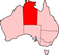
No higher resolution available.
NT_in_Australia_map.png (200 × 186 pixels, file size: 11 KB, MIME type: image/png)
This is a file from the Wikimedia Commons and may be used by other projects. Information from its description page there is shown below. Commons is a freely licensed media file repository. |
This image was copied from wikipedia:en. The original description was:
 | Permission is granted to copy, distribute and/or modify this document under the terms of the GNU Free Documentation License, Version 1.2 or any later version published by the Free Software Foundation; with no Invariant Sections, no Front-Cover Texts, and no Back-Cover Texts. A copy of the license is included in the section entitled GNU Free Documentation License. |
| This file is licensed under the Creative Commons Attribution-Share Alike 3.0 Unported license. | ||
| ||
| This licensing tag was added to this file as part of the GFDL licensing update. |
| date/time | username | edit summary |
|---|---|---|
| 18:21, 12 March 2005 | Zoney | (no longer on main page, rem protect notice) |
| 08:18, 12 March 2005 | PFHLai | (+ {{mprotected}}) |
| 03:33, 4 June 2004 | Template namespace initialisation script | |
| 21:13, 22 February 2004 | Morwen | |
| 04:44, 10 May 2003 | Tim Starling | (Created by me based on Geoscience Australia data) |
 | File:Northern Territory in Australia.svg is a vector version of this file. It should be used in place of this PNG file when not inferior. File:NT in Australia map.png → File:Northern Territory in Australia.svg For more information, see Help:SVG. |  |
File history
Click on a date/time to view the file as it appeared at that time.
| Date/Time | Thumbnail | Dimensions | User | Comment | |
|---|---|---|---|---|---|
| current | 17:10, 8 November 2005 | | 200 × 186 (11 KB) | ChongDae | This image was copied from wikipedia:en. The original description was: {{GFDL}} {| border="1" ! date/time || username || edit summary |---- | 18:21, 12 March 2005 || Zoney || <nowiki>(no longer on main page, rem protect notice)</nowiki> |---- | 08:18, |
File usage
There are no pages that use this file.
Global file usage
The following other wikis use this file:
- Usage on ceb.wikipedia.org
- Usage on en.wikipedia.org
- Barranyi (North Island) National Park
- Iytwelepenty / Davenport Range National Park
- Djukbinj National Park
- Dulcie Range National Park
- Elsey National Park
- Garig Gunak Barlu National Park
- Keep River National Park
- Watarrka National Park
- Foelsche crater
- Lake Bennett (Northern Territory)
- List of highways in the Northern Territory
- Cobourg Peninsula
- Howard Springs Nature Park
- Merlin diamond mine
- Goulburn Islands
- Palm Valley (Northern Territory)
- Lasseter Highway
- Sir Edward Pellew Group of Islands
- Clarence Strait (Northern Territory)
- Tarrabool Lake
- Cape Fourcroy
- Anula, Northern Territory
- Caledon Bay
- Woodah Island
- Template:NorthernTerritory-geo-stub
- Casuarina, Northern Territory
- Imanpa, Northern Territory
- Mount Giles
- Gapuwiyak, Northern Territory
- Cape Crawford
- Kulgera, Northern Territory
- Numbulwar
- Coniston (Northern Territory)
- Twin Falls (Northern Territory)
- Wangi Falls
- Florence Falls
- Tjaynera Falls
- Tolmer Falls
- Arrernte (area)
- Sandover Highway
- Plenty Highway
- Buntine Highway
- Carpentaria Highway
- Bumaga Island
- Rimbija Island
- Warnawi Island
- Cunningham Islands
- Drysdale Island
- Ngalia Basin
View more global usage of this file.
Explore the world

United states
New York

Japan
Tokyo

Singapore
Singapore
