
 Français
 Italiano
Size of this PNG preview of this SVG file: 800 × 488 pixels. Other resolutions: 320 × 195 pixels | 640 × 391 pixels | 1,024 × 625 pixels | 1,280 × 781 pixels | 2,560 × 1,562 pixels | 839 × 512 pixels.
Original file (SVG file, nominally 839 × 512 pixels, file size: 314 KB)
This is a file from the Wikimedia Commons and may be used by other projects. Information from its description page there is shown below. Commons is a freely licensed media file repository. |
Summary
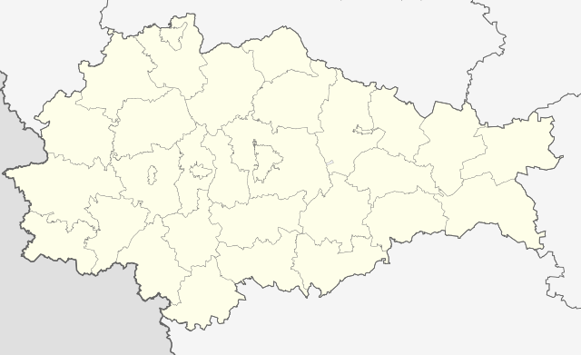
| Description | Outline map of Kursk Oblast, Russia. |
| Date | |
| Source |
This W3C-unspecified vector image was created with Inkscape . |
| Author | Nzeemin |
| Other versions | |

Licensing
| Description | This map was created from OpenStreetMap project data, collected by the community. This map may be incomplete, and may contain errors. Don't rely solely on it for navigation. |
| Date | (see file history) |
| Source | openstreetmap.org |
| Creator | OpenStreetMap contributors |
| Permission (Reusing this file) | OpenStreetMap data and maps are licensed under the Creative Commons Attribution-ShareAlike 2.0 license (CC-BY-SA 2.0). This file is licensed under the Creative Commons Attribution-Share Alike 2.0 Generic license.
|
| Georeferencing | If inappropriate please set warp_status = skip to hide. |
File history
Click on a date/time to view the file as it appeared at that time.
| Date/Time | Thumbnail | Dimensions | User | Comment | |
|---|---|---|---|---|---|
| current | 18:27, 24 October 2015 | | 839 × 512 (314 KB) | Stasyan117 | reduce |
| 17:51, 27 February 2012 |  | 839 × 512 (314 KB) | Nzeemin | {{Information |Description=Outline map of Kursk Oblast, Russia. |Source= * {{own}} {{Inkscape}} |Date= |Author= Nzeemin |Permission= |other_versions= }} |
File usage
There are no pages that use this file.
Global file usage
The following other wikis use this file:
- Usage on af.wikipedia.org
- Usage on ar.wikipedia.org
- Usage on azb.wikipedia.org
- Usage on be.wikipedia.org
- Дзмітрыеў-Льгоўскі
- Абаянь
- Курчатаў (Курская вобласць)
- Льгоў
- Рыльск
- Суджа
- Фацеж
- Шчыгры
- Курск
- Поныры
- Залатухіна (Курская вобласць)
- Касторнае
- Коранева (Курская вобласць)
- Цім (Курская вобласць)
- Кшэнскі
- Гаршэчнае
- Канышэўка
- Шаблон:На карце/Расія Курская вобласць
- Магнітны (Курская вобласць)
- Глушкова (Курская вобласць)
- Кіраўскі (Курская вобласць)
- Чарамісінава
- Прысцень
- Вялікае Салдацкае
- Цёткіна (Курская вобласць)
- Іваніна
- Хамутоўка (Курская вобласць)
- Пасёлак імя Карла Лібкнехта
- Алымскі
- Медзвенка
- Новакасторнае
- Праміцына
- Белая (Курская вобласць)
- Мантурава (Курская вобласць)
- Алешня (Курская вобласць)
- Гогалеўка (Суджанскі раён)
- Рубаншчына
- Ганчароўка (Курская вобласць)
- Зааляшэнка
- Бердзін
- Кругленькае (Курская вобласць)
- Usage on bg.wikipedia.org
- Usage on ceb.wikipedia.org
- Usage on ce.wikipedia.org
View more global usage of this file.
Metadata
Explore the world

United states
New York

Japan
Tokyo

Singapore
Singapore
