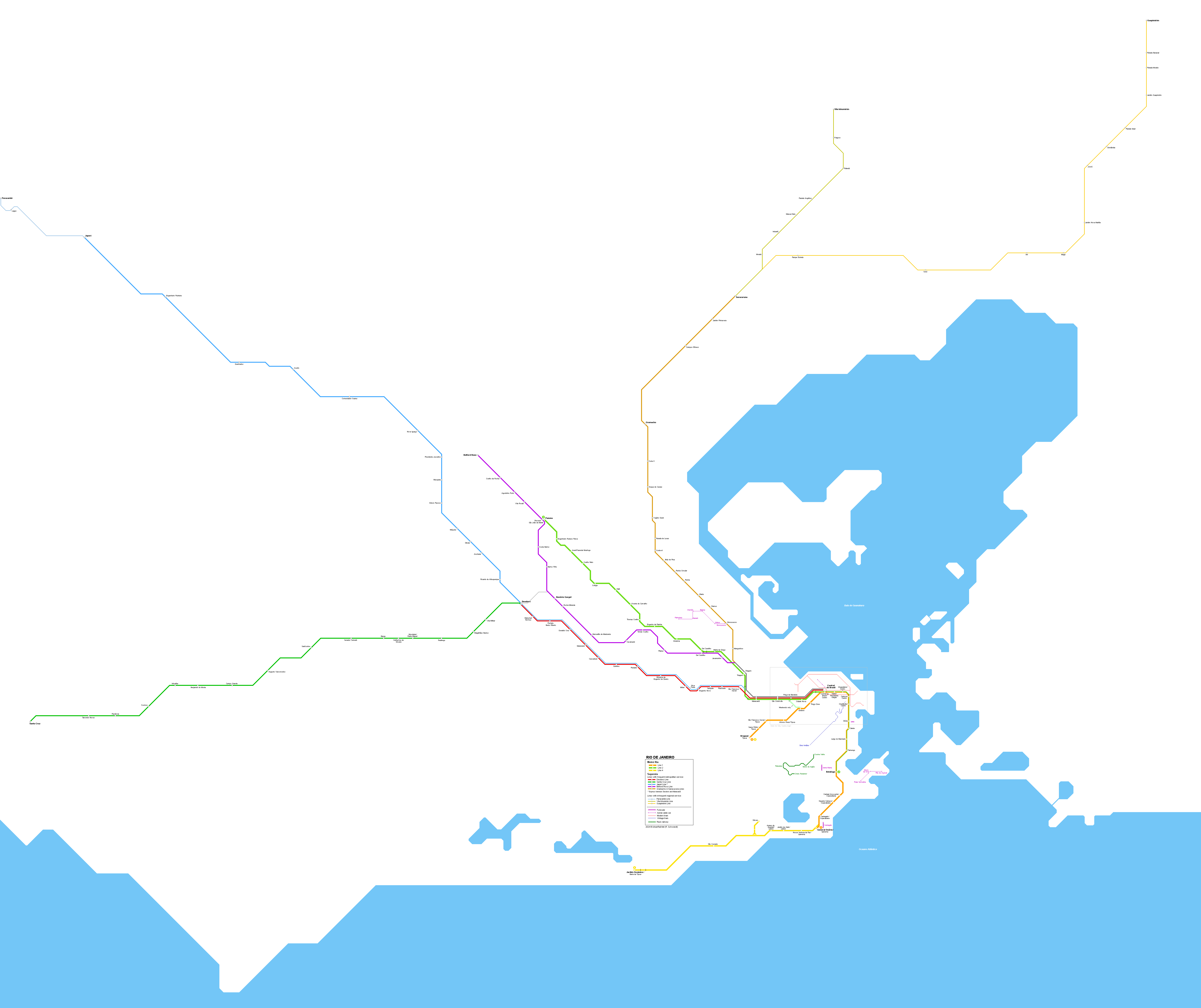
| DescriptionPublic transport map of Rio de Janeiro.svg | English: A map displaying all public transport within Rio de Janeiro metropolitan area, including suburban trains, subway, BRT, light rail, tram, bus corridors, rack railway, cable cars and funiculars. Português: Um mapa com todos os transportes públicos na Região Metropolitana do Rio de Janeiro, incluindo trens suburbanos, metrô, BRT, VLT, bondes, corredores de ônibus, teleféricos e planos inclinados. Rio de Janeiro  | 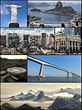 | | Native name | Rio de Janeiro  | | Location | | | Coordinates | 22° 54′ 40″ S, 43° 12′ 20″ W   | | Established | 11 March 1565 | | Website | www.rio.rj.gov.br | | Authority file | | institution QS:P195,Q8678 institution QS:P195,Q18325841 institution QS:P195,Q1133623 institution QS:P195,Q18475351 | Line 1 |  | | Location | | | Established | 5 March 1979 | | Authority file | | institution QS:P195,Q2333617 | Line 2 |  | | Native name | Linha 2 | | Location | | | Established | 19 November 1981 | | Authority file | | institution QS:P195,Q2333639 | Line 4 |  | | Location | | | Established | 30 July 2016 | | Authority file | | institution QS:P195,Q6553130 institution QS:P195,Q10384484 institution QS:P195,Q1125591 institution QS:P195,Q18473921 institution QS:P195,Q10318722 institution QS:P195,Q10318695 institution QS:P195,Q10318719 institution QS:P195,Q10318671 institution QS:P195,Q10318727 institution QS:P195,Q10318744 institution QS:P195,Q10318688 institution QS:P195,Q18195872 institution QS:P195,Q115842233 institution QS:P195,Q7833610 institution QS:P195,Q7833634 institution QS:P195,Q7833637 institution QS:P195,Q10388586 | Line 1 |  | | Location | | | Established | 5 June 2016 | | Authority file | | institution QS:P195,Q30926891 | Line 2 |  | | Location | | | Established | 6 February 2017 | | Authority file | | institution QS:P195,Q30926895 institution QS:P195,Q61000373 institution QS:P195,Q124986510 | Corcovado Rack Railway |  | | Location | | | Coordinates | 22° 57′ 06.12″ S, 43° 12′ 40.32″ W | | Established | 1884 | | Authority file | | institution QS:P195,Q1132053 institution QS:P195,Q1134683 institution QS:P195,Q1864964 institution QS:P195,Q132331895 |

 Français
 Italiano


.png)
.png)
.png)


.svg)


