
 Français
 Italiano
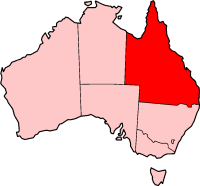
No higher resolution available.
QLD_in_Australia_map.png (200 × 186 pixels, file size: 11 KB, MIME type: image/png)
This is a file from the Wikimedia Commons and may be used by other projects. Information from its description page there is shown below. Commons is a freely licensed media file repository. |
Created by Tim Starling
from en:Image:QLD in Australia map.png
 | File:Queensland in Australia.svg is a vector version of this file. It should be used in place of this PNG file when not inferior. File:QLD in Australia map.png → File:Queensland in Australia.svg For more information, see Help:SVG. |  |
 | Permission is granted to copy, distribute and/or modify this document under the terms of the GNU Free Documentation License, Version 1.2 or any later version published by the Free Software Foundation; with no Invariant Sections, no Front-Cover Texts, and no Back-Cover Texts. A copy of the license is included in the section entitled GNU Free Documentation License. |
| This file is licensed under the Creative Commons Attribution-Share Alike 3.0 Unported license. | ||
| ||
| This licensing tag was added to this file as part of the GFDL licensing update. |
File history
Click on a date/time to view the file as it appeared at that time.
| Date/Time | Thumbnail | Dimensions | User | Comment | |
|---|---|---|---|---|---|
| current | 09:23, 30 November 2004 | | 200 × 186 (11 KB) | Renamed user 73876485f2f7c42af5f2a33994cf3cb0 | from en |
File usage
There are no pages that use this file.
Global file usage
The following other wikis use this file:
- Usage on cs.wikipedia.org
- Usage on de.wikinews.org
- Usage on en.wikipedia.org
- Bang Bang Jump Up
- Wikipedia talk:WikiProject Maps/Archive1
- List of highways in Queensland
- Canterbury, Queensland
- Island Head (Queensland)
- Template:Queensland-geo-stub
- Shrewsbury Rock
- Wunjunga, Queensland
- Wolf Rock (Queensland)
- Hays Inlet
- Bountiful Islands
- Agnes Island
- Hudson Island
- Kumboola Island
- Sisters Island (Queensland)
- Jessie Island
- Lindquist Island
- Russell Island (Frankland Islands)
- Round Island (Queensland)
- Mabel Island
- Normanby Island (Queensland)
- Woody Island (Queensland)
- Struck Island
- Rocky Island (Queensland)
- County of Canning
- Low Wooded Island
- South Direction Island
- North Direction Island
- Murdock Island
- Magra Islet
- Macarthur Islands (Queensland)
- Cholmondeley Islet
- Halfway Island (Queensland)
- Leichhardt Falls
- The Three Sisters (Queensland)
- Cape Manifold
- Gebar Island
- Turnagain Island (Queensland)
- Talbot Islands
- Captains Mountain
- Mount Quincan
- Talk:Aussie salute
- Mount Hopeless (Queensland)
- Combo Waterhole
- Batt Reef
- Stephens Island (Great Barrier Reef)
- Belle Vue Islands
- Gasteracantha fornicata
View more global usage of this file.
Explore the world

United states
New York

Japan
Tokyo

Singapore
Singapore
