
 Français
 Italiano
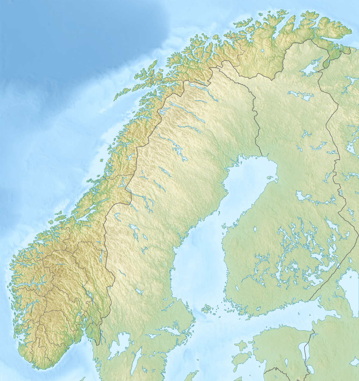
Size of this preview: 564 × 599 pixels. Other resolutions: 226 × 240 pixels | 452 × 480 pixels | 723 × 768 pixels | 1,200 × 1,275 pixels.
Original file (1,200 × 1,275 pixels, file size: 2.13 MB, MIME type: image/png)
This is a file from the Wikimedia Commons and may be used by other projects. Information from its description page there is shown below. Commons is a freely licensed media file repository. |
Summary
| Description | English: Relief map of Norway Equirectangular projection, N/S stretching 210 %. Geographic limits of the map:
|
| Date | |
| Source |
|
| Author | derivative work Виктор_В |
 | File:Norway rel location map.svg is a vector version of this file. It should be used in place of this PNG file when not inferior. File:Relief Map of Norway.png → File:Norway rel location map.svg For more information, see Help:SVG. |  |
Licensing
I, the copyright holder of this work, hereby publish it under the following licenses:
 | Permission is granted to copy, distribute and/or modify this document under the terms of the GNU Free Documentation License, Version 1.2 or any later version published by the Free Software Foundation; with no Invariant Sections, no Front-Cover Texts, and no Back-Cover Texts. A copy of the license is included in the section entitled GNU Free Documentation License. |
This file is licensed under the Creative Commons Attribution-Share Alike 3.0 Unported license.
- You are free:
- to share – to copy, distribute and transmit the work
- to remix – to adapt the work
- Under the following conditions:
- attribution – You must give appropriate credit, provide a link to the license, and indicate if changes were made. You may do so in any reasonable manner, but not in any way that suggests the licensor endorses you or your use.
- share alike – If you remix, transform, or build upon the material, you must distribute your contributions under the same or compatible license as the original.
You may select the license of your choice.
File history
Click on a date/time to view the file as it appeared at that time.
| Date/Time | Thumbnail | Dimensions | User | Comment | |
|---|---|---|---|---|---|
| current | 22:16, 30 December 2017 | | 1,200 × 1,275 (2.13 MB) | NordNordWest | upd 2018 |
| 18:01, 10 December 2010 |  | 1,200 × 1,275 (2.18 MB) | Виктор В | м | |
| 17:42, 28 August 2010 |  | 1,200 × 1,275 (2.4 MB) | Виктор В | Рельеф дна | |
| 16:42, 28 August 2010 |  | 1,200 × 1,275 (1.93 MB) | Виктор В | мелкие исправления | |
| 12:13, 28 August 2010 |  | 1,200 × 1,275 (2.01 MB) | Виктор В | == {{int:filedesc}} == {{Information |Description={{en|Relief map of Norway}} Equirectangular projection, N/S stretching 210 %. Geographic limits of the map: * N: 71.5° N * S: 57.6° N * W: 4.1° E * E: 31.6° E |Source=*[[:File:Norway loc |
File usage
There are no pages that use this file.
Global file usage
The following other wikis use this file:
- Usage on als.wikipedia.org
- Usage on ar.wikipedia.org
- Usage on arz.wikipedia.org
- Usage on ast.wikipedia.org
- Usage on azb.wikipedia.org
- Usage on ba.wikipedia.org
- Usage on be.wikipedia.org
- Шаблон:На карце/Нарвегія
- Руген (возера)
- Бюгдзін
- Фемун
- М’ёса
- Росватн
- Глома
- Бёўра
- Гёўла
- Отра
- Паз
- Ранэльва
- Танаэльва
- Нідэльва
- Вефсна
- Банак
- Брэймсватн
- Клістэрватн
- Кродэрэн
- Ломіватн
- Мёсватн
- Тутак
- Сперылен
- Хелін
- Недрэватн
- Бюглансфіёрд
- Цюрыфіёрд
- Хорніндальсватнет
- Рансфіёрдэн
- Скугсфіёрдватнет
- Осла-фіёрд
- Лафатэнскія астравы
- Вёрынгсфосен
- Вестфіёрд
- Гальхёпіген
- Глітэртын
- Нордкін
- Ютунхеймен
- Нацыянальны парк Юнкердаль
- Оркла
- Юстэдальбрэен
- Офат-фіёрд
- Геаграфія Нарвегіі
View more global usage of this file.
Metadata
Explore the world

United states
New York

Japan
Tokyo

Singapore
Singapore
