
 Français
 Italiano
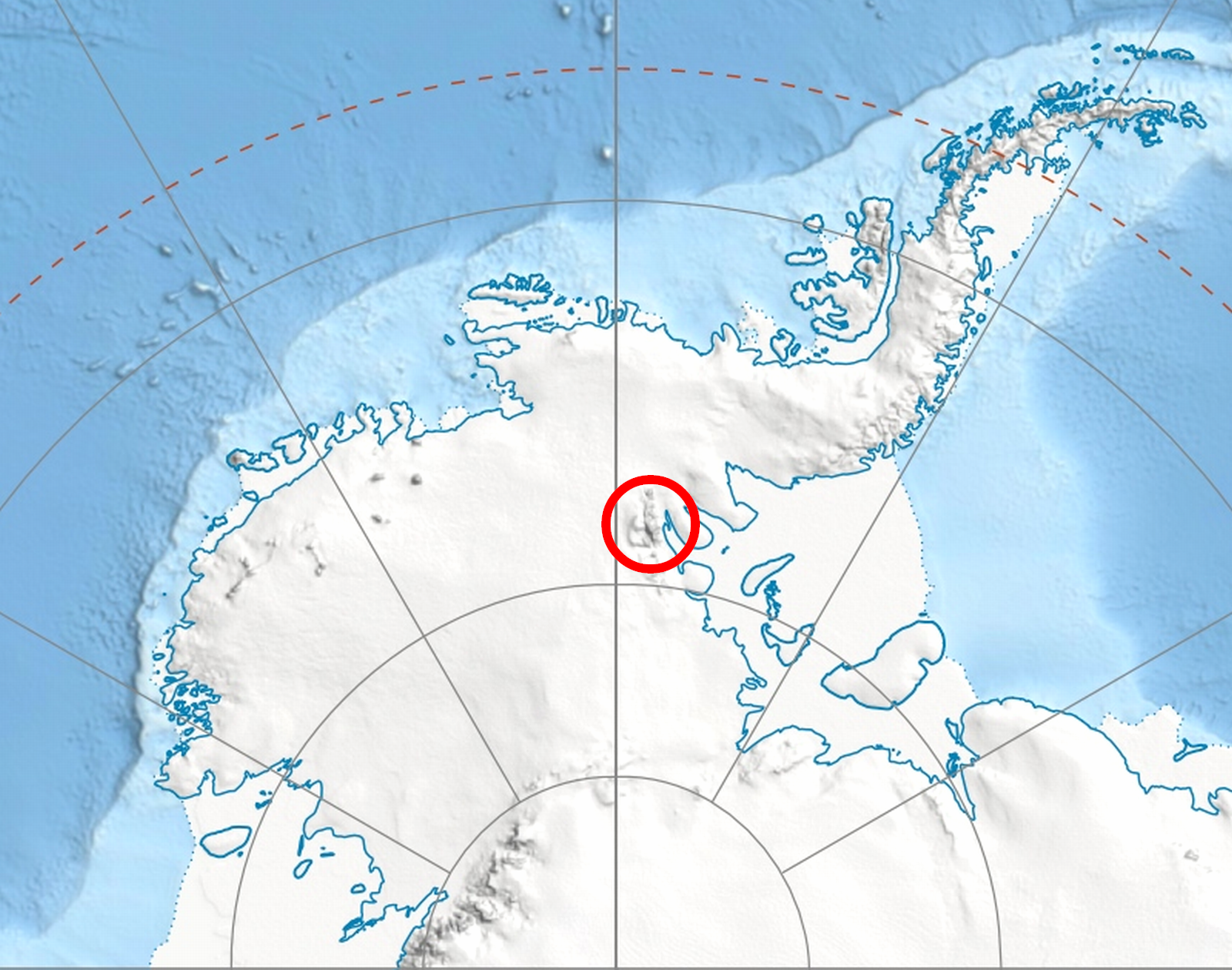
Size of this preview: 761 × 599 pixels. Other resolutions: 305 × 240 pixels | 610 × 480 pixels | 975 × 768 pixels | 1,280 × 1,008 pixels | 1,600 × 1,260 pixels.
Original file (1,600 × 1,260 pixels, file size: 3.04 MB, MIME type: image/png)
This is a file from the Wikimedia Commons and may be used by other projects. Information from its description page there is shown below. Commons is a freely licensed media file repository. |
| Description | |
| Date | (UTC) |
| Source | |
| Author |
|
| This is a retouched picture, which means that it has been digitally altered from its original version. Modifications: PNG fragment of the map with Sentinel Range location shown.. The original can be viewed here: Antarctica relief location map.jpg:
|
I, the copyright holder of this work, hereby publish it under the following license:
This file is licensed under the Creative Commons Attribution-Share Alike 3.0 Unported license.
- You are free:
- to share – to copy, distribute and transmit the work
- to remix – to adapt the work
- Under the following conditions:
- attribution – You must give appropriate credit, provide a link to the license, and indicate if changes were made. You may do so in any reasonable manner, but not in any way that suggests the licensor endorses you or your use.
- share alike – If you remix, transform, or build upon the material, you must distribute your contributions under the same or compatible license as the original.
Original upload log
This image is a derivative work of the following images:
- File:Antarctica_relief_location_map.jpg licensed with Cc-by-sa-3.0
- 2010-02-21T21:24:26Z Alexrk2 1500x1500 (837443 Bytes) == Summary == {{Information |Description= {{de|Physische Positionskarte [[:de:Antarktis|Antarktis]], Mittabstandstreue Azimutalprojektion}} {{en|Physical Location map [[:en:Antarctica|Antarctica]], Azimuthal equidistant proje
Uploaded with derivativeFX
File history
Click on a date/time to view the file as it appeared at that time.
| Date/Time | Thumbnail | Dimensions | User | Comment | |
|---|---|---|---|---|---|
| current | 19:15, 9 July 2010 | | 1,600 × 1,260 (3.04 MB) | Apcbg | {{Information |Description={{en|Location of en:Sentinel Range in en:Western Antarctica.}} |Source=*File:Antarctica_relief_location_map.jpg |Date=2010-07-09 18:30 (UTC) |Author=*File:Antarctica_relief_location_map.jpg: [[User:Alexrk2| |
File usage
There are no pages that use this file.
Global file usage
The following other wikis use this file:
- Usage on ar.wikipedia.org
- Usage on ast.wikipedia.org
- Usage on az.wikipedia.org
- Broks zirvəsi
- Mursalitsa zirvəsi
- Strahil zirvəsi
- Ahrida zirvəsi
- Mirovyane zirvəsi
- Zimornitsa zirvəsi
- Fuça zirvəsi
- Bezden zirvəsi
- Kovil nunatakı
- Bohot nunatakı
- Ostruşa nunatakı
- Beadnos nunatakı
- Oreşak zirvəsi
- Qolemani zirvəsi
- Marsa buzlağı
- Patleyna buzlağı
- Embree buzlağı
- Kopsis buzlağı
- Padala buzlağı
- Ellen buzlağı
- Fonfon buzlağı
- Gerila buzlağı
- Rumyana buzlağı
- Delyo buzlağı
- Burdenis buzlağı
- Arapya buzlağı
- Pulpudeva buzlağı
- Mamarçev zirvəsi
- Usage on bg.wikipedia.org
- Usage on br.wikipedia.org
- Usage on ca.wikipedia.org
- Usage on ceb.wikipedia.org
- Usage on en.wikipedia.org
View more global usage of this file.
Explore the world

United states
New York

Japan
Tokyo

Singapore
Singapore
