
 Français
 Italiano
Size of this PNG preview of this SVG file: 550 × 599 pixels. Other resolutions: 220 × 240 pixels | 441 × 480 pixels | 705 × 768 pixels | 940 × 1,024 pixels | 1,880 × 2,048 pixels | 1,198 × 1,305 pixels.
Original file (SVG file, nominally 1,198 × 1,305 pixels, file size: 2.13 MB)
This is a file from the Wikimedia Commons and may be used by other projects. Information from its description page there is shown below. Commons is a freely licensed media file repository. |
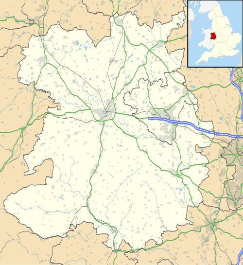
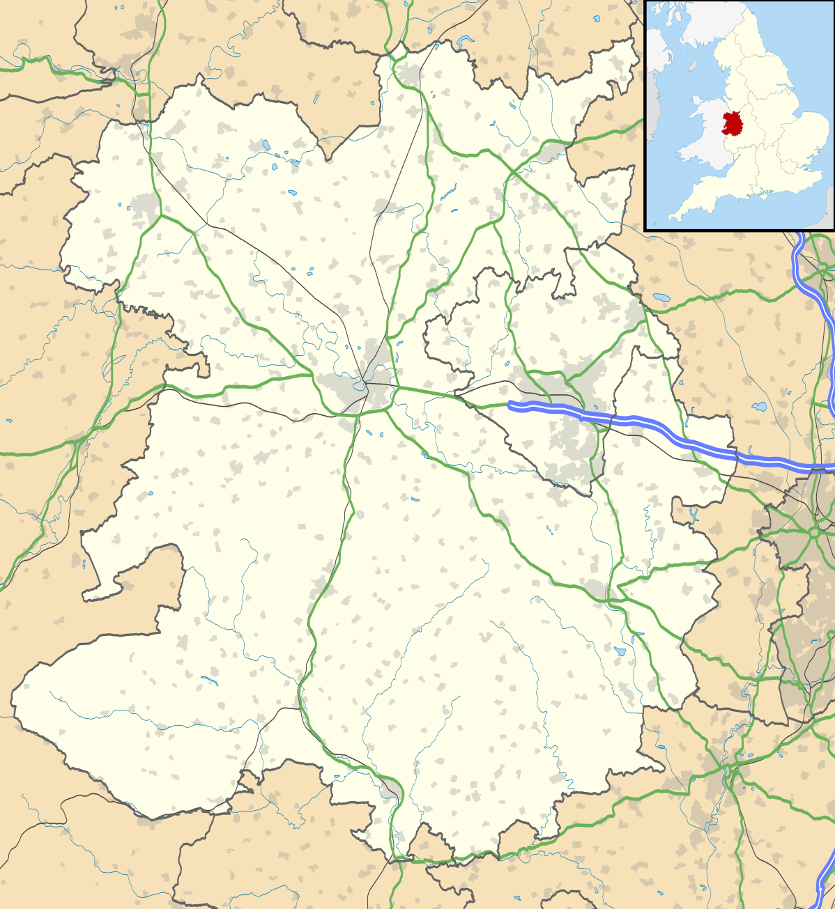
| Description | Map of Shropshire, UK with the following information shown:
Equirectangular map projection on WGS 84 datum, with N/S stretched 165% Geographic limits:
|
| Date | |
| Source |
|
| Author | Nilfanion, created using Ordnance Survey data |
| Permission (Reusing this file) | This file is licensed under the Creative Commons Attribution-Share Alike 3.0 Unported license. Attribution: Contains Ordnance Survey data © Crown copyright and database right
|
| Other versions | File:Shropshire UK district map (blank).svg - Blank map |
.svg)
File history
Click on a date/time to view the file as it appeared at that time.
| Date/Time | Thumbnail | Dimensions | User | Comment | |
|---|---|---|---|---|---|
| current | 19:51, 16 October 2010 | | 1,198 × 1,305 (2.13 MB) | Nilfanion | fix to A442 |
| 19:11, 26 September 2010 |  | 1,198 × 1,305 (2.12 MB) | Nilfanion | {{Information |Description=Map of Shropshire, UK with the following information shown: *Administrative borders *Coastline, lakes and rivers *Roads and railways *Urban areas Equirectangular map projection on WGS 84 datum, with N/S stretch |
File usage
There are no pages that use this file.
Global file usage
The following other wikis use this file:
- Usage on ar.wikipedia.org
- Usage on azb.wikipedia.org
- Usage on bg.wikipedia.org
- Usage on ceb.wikipedia.org
- Usage on cy.wikipedia.org
- Usage on en.wikipedia.org
- Ludlow
- Ironbridge
- Stokesay Castle
- Telford
- Ludlow Castle
- Church Stretton
- Newport, Shropshire
- Oswestry
- Old Oswestry
- Whitchurch, Shropshire
- Market Drayton
- Bishop's Castle
- Bridgnorth
- Ellesmere, Shropshire
- Alveley
- Baschurch
- Woore
- Ruyton-XI-Towns
- Viroconium Cornoviorum
- Sheriffhales
- Weston Lullingfields
- Wroxeter
- Hampton Loade
- Clun
- Coalbrookdale
- Atcham
- Clun Castle
- Shawbury
- Shrewsbury Castle
- Attingham Park
- Wellington, Shropshire
- Oakengates
- Donnington, Telford
- Wem
- RAF Shawbury
- Much Wenlock
- Hopton Heath
- Sundorne
- Harlescott
- Ditherington
- Nesscliffe
- Cleobury Mortimer
- Hay Inclined Plane
- Snailbeach
- Pontesbury
View more global usage of this file.
Explore the world

United states
New York

Japan
Tokyo

Singapore
Singapore
