
 Français
 Italiano
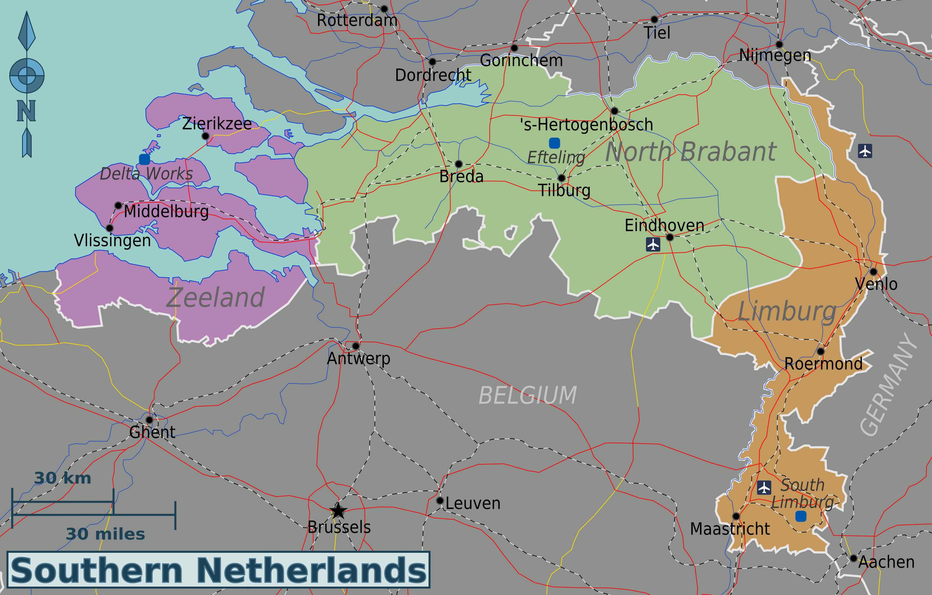
Size of this preview: 800 × 511 pixels. Other resolutions: 320 × 204 pixels | 640 × 409 pixels | 1,024 × 654 pixels | 1,280 × 817 pixels | 3,001 × 1,916 pixels.
Original file (3,001 × 1,916 pixels, file size: 1.31 MB, MIME type: image/png)
This is a file from the Wikimedia Commons and may be used by other projects. Information from its description page there is shown below. Commons is a freely licensed media file repository. |
Summary
| Description | English: Map of the Southern Netherlands. |
| Date | |
| Source | Own work based on University of Texas Library - Perry Castañeda Map Collection (public domain); ATB-kaart.png (public domain) by LennartBolks for rails; and SnelwegenNederland 2008.png (CC-BY-SA-3.0) by T Houdijk for roads. |
| Author | Globe-trotter |
| Other versions | Southern-netherlands-map.svg |
Licensing
I, the copyright holder of this work, hereby publish it under the following license:
This file is licensed under the Creative Commons Attribution-Share Alike 3.0 Unported license.
- You are free:
- to share – to copy, distribute and transmit the work
- to remix – to adapt the work
- Under the following conditions:
- attribution – You must give appropriate credit, provide a link to the license, and indicate if changes were made. You may do so in any reasonable manner, but not in any way that suggests the licensor endorses you or your use.
- share alike – If you remix, transform, or build upon the material, you must distribute your contributions under the same or compatible license as the original.
File history
Click on a date/time to view the file as it appeared at that time.
| Date/Time | Thumbnail | Dimensions | User | Comment | |
|---|---|---|---|---|---|
| current | 01:30, 22 January 2013 | | 3,001 × 1,916 (1.31 MB) | Globe-trotter | {{Information |Description ={{en|1=Map of the Southern Netherlands.}} |Source ={{own}} based on [http://www.lib.utexas.edu/maps/netherlands.html University of Texas Library - Perry Castañeda Map Collection] (public domain); [[:File:ATB-kaar... |
File usage
The following 2 pages use this file:
Global file usage
The following other wikis use this file:
- Usage on el.wikivoyage.org
- Usage on es.wikivoyage.org
- Usage on he.wikivoyage.org
- Usage on it.wikivoyage.org
- Usage on nl.wikivoyage.org
Metadata
Explore the world

United states
New York

Japan
Tokyo

Singapore
Singapore
