
 Français
 Italiano
Size of this PNG preview of this SVG file: 733 × 600 pixels. Other resolutions: 293 × 240 pixels | 587 × 480 pixels | 939 × 768 pixels | 1,252 × 1,024 pixels | 2,503 × 2,048 pixels | 1,425 × 1,166 pixels.
Original file (SVG file, nominally 1,425 × 1,166 pixels, file size: 2.59 MB)
This is a file from the Wikimedia Commons and may be used by other projects. Information from its description page there is shown below. Commons is a freely licensed media file repository. |
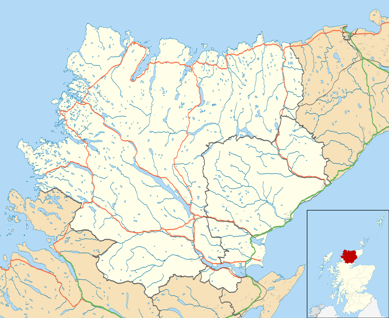
| Description | Map of Sutherland, UK in 2011, with the following information shown:
Equirectangular map projection on WGS 84 datum, with N/S stretched 180% Geographic limits:
|
| Date | |
| Source |
|
| Author | Nilfanion, created using Ordnance Survey data |
| Permission (Reusing this file) | This file is licensed under the Creative Commons Attribution-Share Alike 3.0 Unported license. Attribution: Contains Ordnance Survey data © Crown copyright and database right
|
| Other versions | File:Sutherland UK blank map.svg - Blank map |
File history
Click on a date/time to view the file as it appeared at that time.
| Date/Time | Thumbnail | Dimensions | User | Comment | |
|---|---|---|---|---|---|
| current | 13:22, 24 February 2011 | | 1,425 × 1,166 (2.59 MB) | Nilfanion | {{Information |Description=Map of Sutherland, UK in 2011, with the following information shown: *Ward boundaries *Coastline and lakes *Roads and railways *Urban areas Equirectangular map projection on WGS 84 datum, with N/S stretched 180 |
File usage
There are no pages that use this file.
Global file usage
The following other wikis use this file:
- Usage on ar.wikipedia.org
- Usage on ceb.wikipedia.org
- Usage on en.wikipedia.org
- Dornoch
- Durness
- Tongue, Sutherland
- Helmsdale
- Kinlochbervie
- Coldbackie
- Loch Fleet
- Lairg
- Forsinard
- Brora
- Scourie
- Bonar Bridge
- Lochinver
- Clashnessie
- Bettyhill
- Golspie
- Achany
- Achfary
- Achmelvich
- Achnacarnin
- Achnairn
- Achriesgill
- Achvaich
- Assynt
- Dornoch Cathedral
- Dunrobin Castle
- Kinbrace
- Rogart
- Ardgay
- Inveran
- Embo, Sutherland
- Upper Bighouse
- Achavandra Muir
- Culrain
- Eriboll
- Strathy
- Melvich
- Achfrish
- Achina, Highland
- Achrimsdale
- Altass
- Ardachu
- Ardchronie
- Borgie
- Aultiphurst
- Badninish
- Evelix
- Inchnadamph
View more global usage of this file.
Explore the world

United states
New York

Japan
Tokyo

Singapore
Singapore
