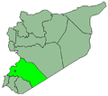
SyriaRifDimasq.PNG (672 × 594 pixels, file size: 17 KB, MIME type: image/png)
File history
Click on a date/time to view the file as it appeared at that time.
| Date/Time | Thumbnail | Dimensions | User | Comment | |
|---|---|---|---|---|---|
| current | 23:13, 15 August 2007 |  | 672 × 594 (17 KB) | KureCewlik81 | |
| 00:32, 15 May 2006 |  | 672 × 594 (17 KB) | KureCewlik81 | {{Information| |Description=the syrian governate of rif dimasq |Source=selfmade |Date=14.05.06 |Author=KureCewlik81 |Permission= |other_versions= }} Category:Maps of Syria |
File usage
There are no pages that use this file.
Global file usage
The following other wikis use this file:
- Usage on ar.wikipedia.org
- Usage on arz.wikipedia.org
- Usage on az.wikipedia.org
- Usage on bn.wikipedia.org
- Usage on ckb.wikipedia.org
- Usage on diq.wikipedia.org
- Usage on el.wikipedia.org
- Usage on en.wikipedia.org
- Maaloula
- Saidnaya
- Al-Zabadani
- Rif Dimashq Governorate
- Sakka, Rif Dimashq Governorate
- Jaramana
- Al-Hamah
- Bloudan
- Harasta
- Yabroud
- Al-Nabek
- Douma, Syria
- Darayya
- Al-Hajar al-Aswad
- Al-Tall, Syria
- Al-Qutayfah
- Qatana
- Al-Qutayfah District
- An-Nabek District
- Al-Tall District
- Darayya District
- Markaz Rif Dimashq District
- Douma District
- Qatana District
- Yabroud District
- Al-Zabadani District
- Madaya, Syria
- Serghaya
- Al-Kiswah
- Deir Atiyah
- Artouz
- Al-Sahel
- Template:Rif Dimashq Governorate
View more global usage of this file.


 Français
 Italiano


