
 Français
 Italiano
Size of this PNG preview of this SVG file: 630 × 600 pixels. Other resolutions: 252 × 240 pixels | 504 × 480 pixels | 807 × 768 pixels | 1,076 × 1,024 pixels | 2,152 × 2,048 pixels | 3,302 × 3,143 pixels.
Original file (SVG file, nominally 3,302 × 3,143 pixels, file size: 1.04 MB)
This is a file from the Wikimedia Commons and may be used by other projects. Information from its description page there is shown below. Commons is a freely licensed media file repository. |
Summary
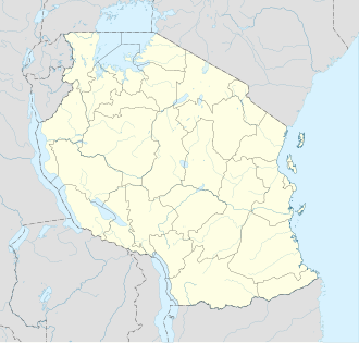
| Description | Equirectangular projection. 0.25° N, 28° W, 42° E, -13° S. Center : -6.375 35 | ||
| Date | (UTC) | ||
| Source | |||
| Author |
| ||
| Other versions | Derivative works of this file: Iringa Regionen.png []
| ||
| Attribution (required by the license) | © Sémhur / Wikimedia Commons / | ||
| SVG | W3C-validity not checked.
| ||
| Graphic Lab |


| Object location | | View this and other nearby images on: OpenStreetMap |
|---|
Licensing
I, the copyright holder of this work, hereby publish it under the following licenses:
This file is licensed under the Creative Commons Attribution-Share Alike 4.0 International, 3.0 Unported, 2.5 Generic, 2.0 Generic and 1.0 Generic license.
- You are free:
- to share – to copy, distribute and transmit the work
- to remix – to adapt the work
- Under the following conditions:
- attribution – You must give appropriate credit, provide a link to the license, and indicate if changes were made. You may do so in any reasonable manner, but not in any way that suggests the licensor endorses you or your use.
- share alike – If you remix, transform, or build upon the material, you must distribute your contributions under the same or compatible license as the original.
| Copyleft: This work of art is free; you can redistribute it and/or modify it according to terms of the Free Art License. You will find a specimen of this license on the Copyleft Attitude site as well as on other sites. |
You may select the license of your choice.
Original upload log
This image is a derivative work of the following images:
- File:Tanzania_map-fr.svg licensed with Cc-by-sa-3.0,2.5,2.0,1.0, GFDL
- 2009-03-20T13:30:18Z Sémhur 3096x3113 (3225659 Bytes) Ol Doinyo Lengaï was misplaced
- 2009-03-20T11:14:35Z Sémhur 3096x3113 (3224368 Bytes) Add location map and few summits.
- 2009-03-19T17:14:13Z Sémhur 3096x3113 (3099209 Bytes) grrr...
- 2009-03-19T17:08:18Z Sémhur 3096x3113 (3099244 Bytes) Oups ! It wasn't the valid one.
- 2009-03-19T17:05:02Z Sémhur 3096x3113 (3122421 Bytes) {{Information |Description={{en|1=Map of [[:en:Tanzania]].}} {{fr|1=Carte de la [[:fr:Tanzanie]].}} {{es|1=Mapa de [[:es:Tanzania]].}} |Source=travail personnel (own work). Sources of data: * Elevations : NASA SRTM3 (public d
Uploaded with derivativeFX
Original upload log
| date/time | username | resolution | size | edit summary |
|---|---|---|---|---|
| 2009-05-03T08:48:31Z | User:Sémhur | 3096×2947 | 828.71Kb | borders above waters |
| 2009-05-03T08:45:18Z | User:Sémhur | 3096×2947 | 828.72Kb | Adding border between Arusha and Manyara |
| 2009-05-01T18:46:42Z | User:Sémhur | 3096×2947 | 822.6Kb | {{int:summary}} {{Information |Description={{en|1=Location map of [[:en:Tanzania]].}} {{fr|1=Carte de géolocalisation de la [[:fr:Tanzanie]].}} {{es|1=Mapa de georreferenciación de [[:es:Tanzania]].}} Equirectangular projection. 0.25° N, 28° W, 42° |
File history
Click on a date/time to view the file as it appeared at that time.
| Date/Time | Thumbnail | Dimensions | User | Comment | |
|---|---|---|---|---|---|
| current | 20:15, 25 May 2017 | | 3,302 × 3,143 (1.04 MB) | Sémhur | Updated with Songwe Region |
| 14:16, 13 December 2013 |  | 3,096 × 2,947 (1.03 MB) | Sémhur | Updated with the four new regions | |
| 00:30, 25 July 2009 |  | 3,096 × 2,947 (829 KB) | BetacommandBot | move approved by: User:Sémhur This image was moved from File:Tanzania location equirectangular map.svg =={{int:summary}}== {{Information |Description={{en|1=Location map of en:Tanzania.}} {{fr|1=Carte de géolocalisation de la [[:fr:Tanz |
File usage
There are no pages that use this file.
Global file usage
The following other wikis use this file:
- Usage on af.wikipedia.org
- Usage on als.wikipedia.org
- Usage on am.wikipedia.org
- Usage on an.wikipedia.org
- Usage on ar.wikipedia.org
- Usage on ast.wikipedia.org
- Monte Kilimanjaro
- Llagu Tanganica
- Llagu Victoria
- Dodoma
- Dar es Salaam
- Mahenge
- Montes Kipengere
- Montes Pare
- Montes Usambara
- Pradera volcánica del Serengueti
- Llagu Rukwa
- Llagu Eyasi
- Llagu Natron
- Parque nacional Serengueti
- Módulu:Mapa de llocalización/datos/Tanzania
- Módulu:Mapa de llocalización/datos/Tanzania/usu
- Archipiélagu de Zanzíbar
- Mezquita Gadafi
- Bagamoyo
- Gargüelu d'Olduvai
- Gran Mezquita de Kilwa
- Kilwa Kisiwani
- Parque nacional Arusha
- Aeropuertu de Songwe
- Kigoma
- Puertu de Dar es Salaam
- Puertu de Tanga
- Usage on av.wikipedia.org
- Usage on azb.wikipedia.org
View more global usage of this file.
Metadata
Explore the world

United states
New York

Japan
Tokyo

Singapore
Singapore
