
 Français
 Italiano
Size of this PNG preview of this SVG file: 391 × 600 pixels. Other resolutions: 156 × 240 pixels | 313 × 480 pixels | 500 × 768 pixels | 667 × 1,024 pixels | 1,335 × 2,048 pixels | 500 × 767 pixels.
Original file (SVG file, nominally 500 × 767 pixels, file size: 581 KB)
This is a file from the Wikimedia Commons and may be used by other projects. Information from its description page there is shown below. Commons is a freely licensed media file repository. |
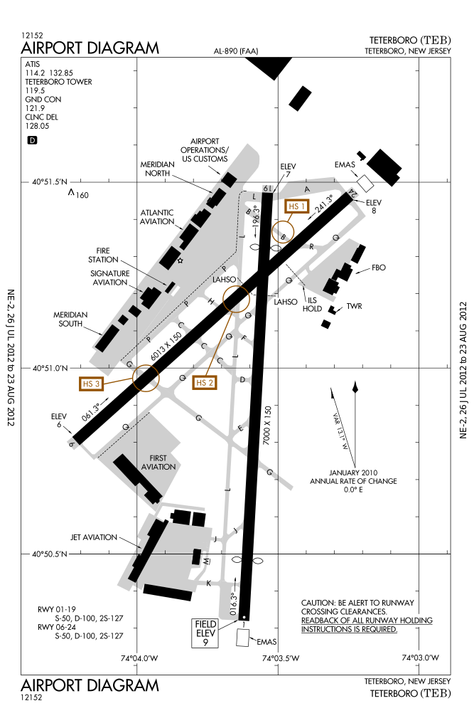
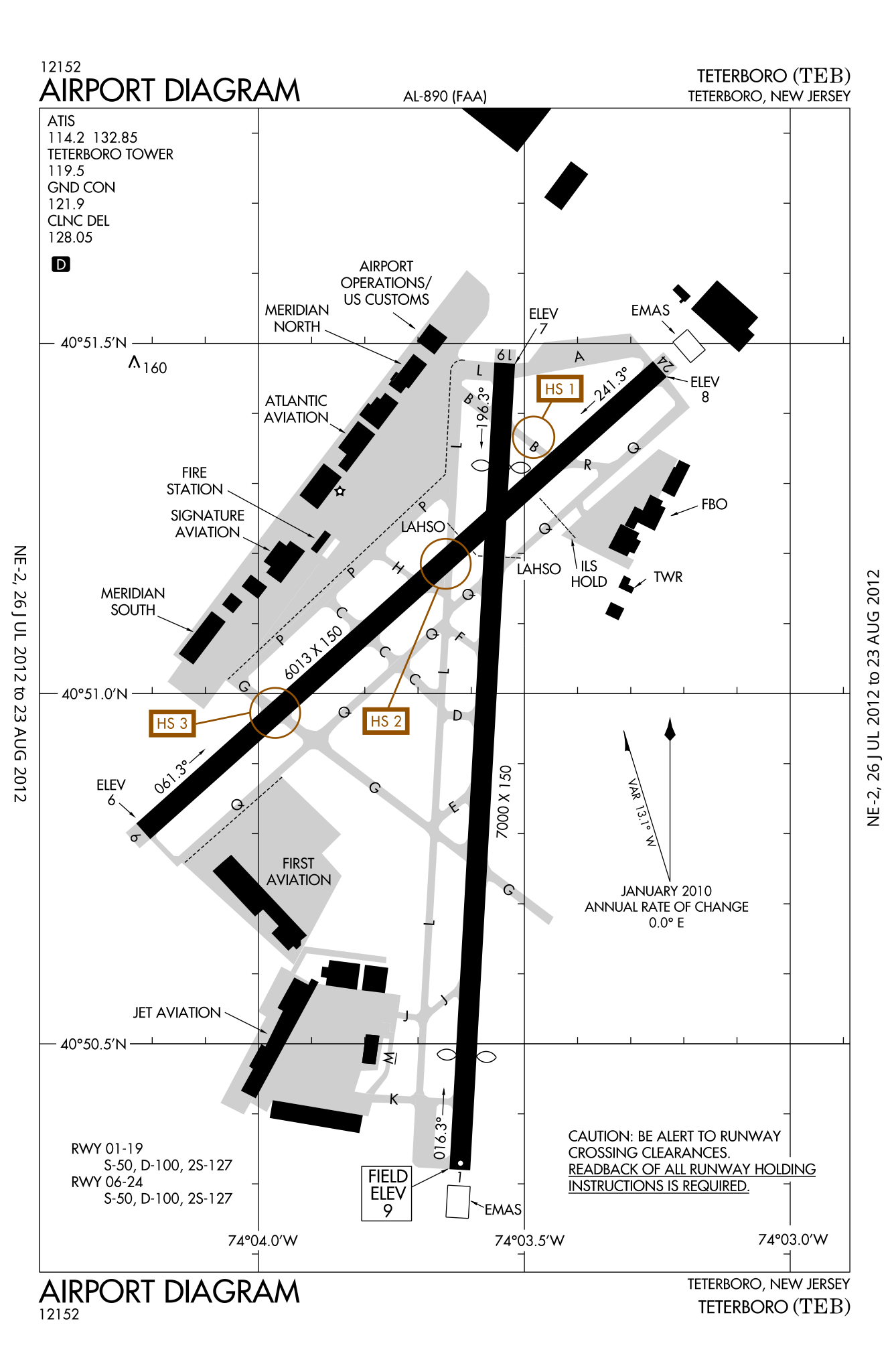
| Description | English: FAA airport diagram for Teterboro Airport (TEB) in Teterboro, New Jersey, United States | |||
| Date | Effective 2012-07-26 to 2012-08-23 | |||
| Source | [1] Note that this URL changes every 28 days; the airport article should contain a link to the current FAA diagram. | |||
| Author | Produced by the National Aeronautical Charting Office (NACO), a department of the Federal Aviation Administration (FAA) | |||
| Permission (Reusing this file) |
|

File history
Click on a date/time to view the file as it appeared at that time.
| Date/Time | Thumbnail | Dimensions | User | Comment | |
|---|---|---|---|---|---|
| current | 05:23, 31 July 2012 | | 500 × 767 (581 KB) | Renamed user KdYpUvMgT | size |
| 05:14, 31 July 2012 |  | 387 × 594 (581 KB) | Renamed user KdYpUvMgT | {{Information |Description ={{en|1=FAA airport diagram for Teterboro Airport (TEB) in Teterboro, New Jersey, United States}} |Source =[http://aeronav.faa.gov/d-tpp/1208/00890AD.PDF]<br />Note that this URL changes [... |
File usage
There are no pages that use this file.
Global file usage
The following other wikis use this file:
- Usage on en.wikipedia.org
- Usage on id.wikipedia.org
- Usage on it.wikipedia.org
- Usage on ja.wikipedia.org
- Usage on no.wikipedia.org
- Usage on ur.wikipedia.org
Explore the world

United states
New York

Japan
Tokyo

Singapore
Singapore
