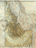
Size of this PNG preview of this SVG file: 457 × 599 pixels. Other resolutions: 183 × 240 pixels | 366 × 480 pixels | 585 × 768 pixels | 781 × 1,024 pixels | 1,561 × 2,048 pixels | 915 × 1,200 pixels.
Original file (SVG file, nominally 915 × 1,200 pixels, file size: 3.67 MB)
File history
Click on a date/time to view the file as it appeared at that time.
| Date/Time | Thumbnail | Dimensions | User | Comment | |
|---|---|---|---|---|---|
| current | 22:45, 30 January 2021 |  | 915 × 1,200 (3.67 MB) | SANtosito | Uploaded own work with UploadWizard |
File usage
There are no pages that use this file.
Global file usage
The following other wikis use this file:
- Usage on bn.wikipedia.org
- Usage on ca.wikipedia.org
- Usage on de.wikipedia.org
- Bear Lake (Idaho/Utah)
- Priest Lake (Idaho)
- Borah Peak
- Dworshak-Talsperre
- Massacre Rocks State Park
- Coeur d’Alene Lake
- Vorlage:Positionskarte USA Idaho
- American Falls Reservoir
- Arrowrock-Talsperre
- Bald Mountain (Idaho)
- Pot Mountain (Idaho)
- KBFI (Mittelwellensender)
- KYZK
- KOFE
- Lake Pend Oreille
- Shoshone Falls
- Kraftwerk Albeni Falls
- Nez Perce National Forest
- Talsperre Palisades
- KIYE
- Land of the Yankee Fork State Park
- Lake Walcott
- Benutzer:Valo139/Clearwater National Forest
- Clearwater National Forest
- City of Rocks National Reserve
- Granite Pass (California Trail)
- East Butte
- Big Southern Butte
- Usage on en.wikipedia.org
- Lewiston, Idaho
- Hailey, Idaho
- Sun Valley, Idaho
- Idaho Falls, Idaho
- Butte City, Idaho
- Coeur d'Alene, Idaho
- Hells Canyon
- Craters of the Moon National Monument and Preserve
- Bruneau River
- SL-1
- Teton Dam
- Bruneau Dunes State Park
- Hells Gate State Park
- Lake Hayden
- Galena Summit
- Borah Peak
- Teton River (Idaho)
View more global usage of this file.


 Français
 Italiano


