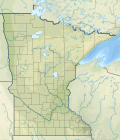
Size of this PNG preview of this SVG file: 514 × 599 pixels. Other resolutions: 206 × 240 pixels | 412 × 480 pixels | 658 × 768 pixels | 878 × 1,024 pixels | 1,756 × 2,048 pixels | 1,029 × 1,200 pixels.
Original file (SVG file, nominally 1,029 × 1,200 pixels, file size: 2.93 MB)
File history
Click on a date/time to view the file as it appeared at that time.
| Date/Time | Thumbnail | Dimensions | User | Comment | |
|---|---|---|---|---|---|
| current | 22:09, 31 January 2021 |  | 1,029 × 1,200 (2.93 MB) | SANtosito | Uploaded own work with UploadWizard |
File usage
There are no pages that use this file.
Global file usage
The following other wikis use this file:
- Usage on ban.wikipedia.org
- Usage on ca.wikipedia.org
- Usage on de.wikipedia.org
- Itasca State Park
- Lake Vermilion
- Leech Lake
- Bde Maka Ska
- Rainy Lake
- Lake Itasca
- Split Rock Lighthouse State Park
- Lake Traverse
- Big Stone Lake
- Vorlage:Positionskarte USA Minnesota
- Gooseberry Falls State Park
- Minnesota Point
- Eagle Mountain (Minnesota)
- Lake Minnetonka
- Klima in Minnesota
- Lake Vermilion-Soudan Underground Mine State Park
- Mille Lacs Lake
- Lake Pepin
- Lake Abita
- Temperance River State Park
- Shady Oak Lake
- Getchell Lake
- Red Lake (See, Minnesota)
- KDIO
- Ge-be-on-e-quet Lake
- KPRM
- Pug Hole Lake (Crow Wing County)
- Norway Lake (Cass County)
- Detroit Lake (Minnesota)
- Lac la Croix
- Namakan Lake
- Basswood Lake (Basswood River)
- Saganaga Lake
- Pelican Lake (Otter Tail County, Minnesota)
- Pelican Lake (St. Louis County, Minnesota)
- Crooked Lake (Boundary Waters)
- Lake Shetek
- Lake Shetek State Park
- Big Carnelian Lake
- Pigeon Lake (Minnesota)
- Lower Sioux Agency
- Prairie Island Indian Community
- Upper Sioux Agency
- Upper Sioux Indian Reservation
- White Earth Indian Reservation
- KTLK
- Big Pine Lake (Otter Tail County, Minnesota)
View more global usage of this file.


 Français
 Italiano


