
 Français
 Italiano
Size of this PNG preview of this SVG file: 800 × 475 pixels. Other resolutions: 320 × 190 pixels | 640 × 380 pixels | 1,024 × 608 pixels | 1,280 × 759 pixels | 2,560 × 1,519 pixels | 1,800 × 1,068 pixels.
Original file (SVG file, nominally 1,800 × 1,068 pixels, file size: 1.16 MB)
This is a file from the Wikimedia Commons and may be used by other projects. Information from its description page there is shown below. Commons is a freely licensed media file repository. |
Summary
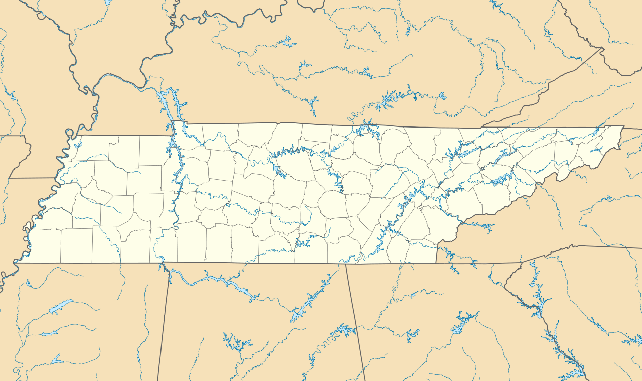
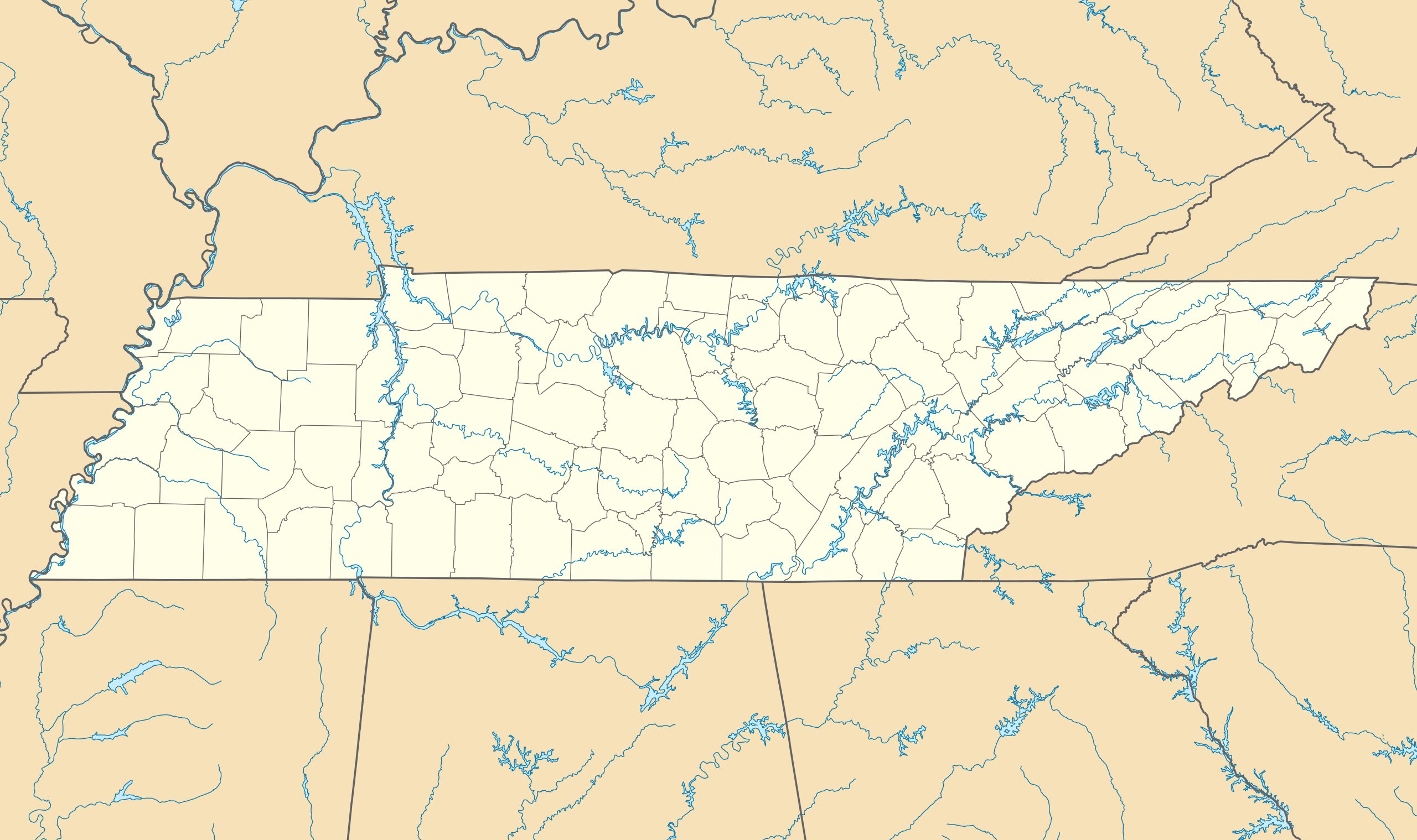
| Description | Quadratische Plattkarte, N-S-Streckung 120.0 %. Geographische Begrenzung der Karte:
Equirectangular projection, N/S stretching 120.0 %. Geographic limits of the map:
|
| Date | |
| Source | Own work |
| Author | Alexrk |
| Other versions | Derivative works of this file: BMO Harris Bank 2012-06.png Derivative works of this file: |
 | This map has been made or improved in the German Kartenwerkstatt (Map Lab). You can propose maps to improve as well. |
Licensing
I, the copyright holder of this work, hereby publish it under the following licenses:
 | Permission is granted to copy, distribute and/or modify this document under the terms of the GNU Free Documentation License, Version 1.2 or any later version published by the Free Software Foundation; with no Invariant Sections, no Front-Cover Texts, and no Back-Cover Texts. A copy of the license is included in the section entitled GNU Free Documentation License. |
This file is licensed under the Creative Commons Attribution 3.0 Unported license.
- You are free:
- to share – to copy, distribute and transmit the work
- to remix – to adapt the work
- Under the following conditions:
- attribution – You must give appropriate credit, provide a link to the license, and indicate if changes were made. You may do so in any reasonable manner, but not in any way that suggests the licensor endorses you or your use.
You may select the license of your choice.
File history
Click on a date/time to view the file as it appeared at that time.
| Date/Time | Thumbnail | Dimensions | User | Comment | |
|---|---|---|---|---|---|
| current | 10:17, 20 June 2009 | | 1,800 × 1,068 (1.16 MB) | Alexrk2 | page ratio, water bodies |
| 16:00, 13 June 2009 | 1,500 × 415 (246 KB) | Alexrk | == Beschreibung == {{Information |Description= {{de|Positionskarte von Tennessee, USA}} Quadratische Plattkarte, N-S-Streckung 120.0 %. Geographische Begrenzung der Karte: * N: 36.9° N * S: 34.8° N * W: 90.5° W * O: 81.4° |
File usage
There are no pages that use this file.
Global file usage
The following other wikis use this file:
- Usage on af.wikipedia.org
- Usage on an.wikipedia.org
- Usage on ar.wikipedia.org
- Usage on azb.wikipedia.org
- آرکیدیا، تنسی
- کازبی، تنسی
- داردن، تنسی
- ترید، تنسی
- دل ریو، تنسی
- لنکستر، تنسی
- اپلتن، تنسی
- الموود، تنسی
- الندیل، تنسی
- باتلر، تنسی
- برانزویک، تنسی
- بلفاست، تنسی
- بوئنا ویستا، تنسی
- بیق راک، تنسی
- بیکرویل، تنسی
- بیکول، تنسی
- چستنات هیل، تنسی
- دراموندز، تنسی
- فراترویل، تنسی
- فروتویل، تنسی
- فری هیل، تنسی
- کاریتون، تنسی
- کراکت میلز، تنسی
- کونکورد، تنسی
- نیملس، تنسی
- هابرشام، تنسی
- هالز، کراسرود، تنسی
- همپتون، تنسی
- هیلتاون، تنسی
- یام یام، تنسی
- قریمزلی، تنسی
- ویرز ولی، تنسی
- بلکمن، تنسی
- آفتون، تنسی
- سویت لیپس، تنسی
- مورفرزبورو، تنسی
- تافت، تنسی
- آلدر برانچ، تنسی
- تالبوت، تنسی
- تالاسی، تنسی
- کوتونتوون، تنسی
- آلکساندریا، تنسی
- والکرتوون، تنسی
- والاند، تنسی
- والینق، تنسی
View more global usage of this file.
Metadata
Explore the world

United states
New York

Japan
Tokyo

Singapore
Singapore
