
 Français
 Italiano
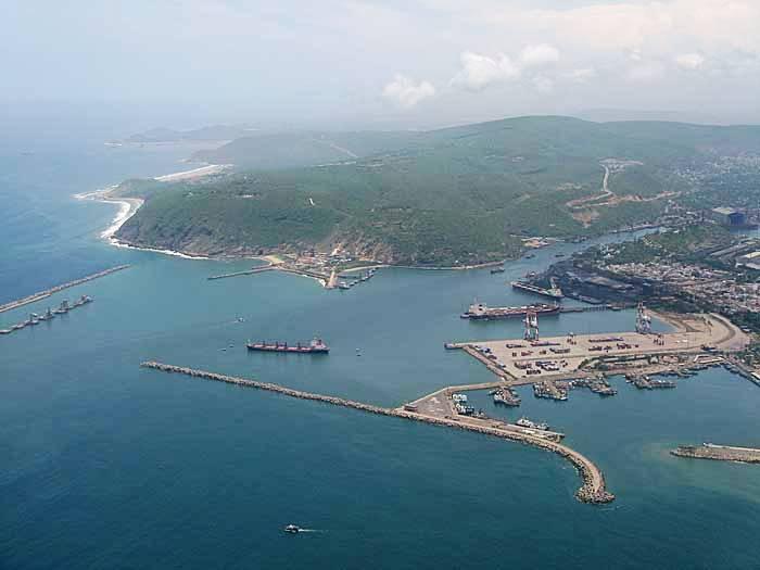
No higher resolution available.
Vizag_Seaport_aerial_view.jpg (700 × 525 pixels, file size: 35 KB, MIME type: image/jpeg)
This is a file from the Wikimedia Commons and may be used by other projects. Information from its description page there is shown below. Commons is a freely licensed media file repository. |
Summary
| Description | English: Visakhapatnam, India. |
| Date | 28 September 2008 (original upload date) |
| Source | Transferred from en.wikipedia to Commons by Kajasudhakarababu using CommonsHelper. |
| Author | Sureshiras at English Wikipedia |
Licensing
Sureshiras at English Wikipedia, the copyright holder of this work, hereby publishes it under the following licenses:
This file is licensed under the Creative Commons Attribution-Share Alike 3.0 Unported license.
Attribution: Sureshiras at English Wikipedia
- You are free:
- to share – to copy, distribute and transmit the work
- to remix – to adapt the work
- Under the following conditions:
- attribution – You must give appropriate credit, provide a link to the license, and indicate if changes were made. You may do so in any reasonable manner, but not in any way that suggests the licensor endorses you or your use.
- share alike – If you remix, transform, or build upon the material, you must distribute your contributions under the same or compatible license as the original.
 | Permission is granted to copy, distribute and/or modify this document under the terms of the GNU Free Documentation License, Version 1.2 or any later version published by the Free Software Foundation; with no Invariant Sections, no Front-Cover Texts, and no Back-Cover Texts. A copy of the license is included in the section entitled GNU Free Documentation License. |
You may select the license of your choice.
Original upload log
The original description page was here. All following user names refer to en.wikipedia.
- 2008-09-28 06:06 Sureshiras 700×525× (35580 bytes)
File history
Click on a date/time to view the file as it appeared at that time.
| Date/Time | Thumbnail | Dimensions | User | Comment | |
|---|---|---|---|---|---|
| current | 13:52, 28 July 2009 | | 700 × 525 (35 KB) | File Upload Bot (Magnus Manske) | {{BotMoveToCommons|en.wikipedia|year={{subst:CURRENTYEAR}}|month={{subst:CURRENTMONTHNAME}}|day={{subst:CURRENTDAY}}}} {{Information |Description={{en|Visakhapatnam, India.}} |Source=Transferred from [http://en.wikipedia.org en.wikipedia]; transferred to |
File usage
There are no pages that use this file.
Global file usage
The following other wikis use this file:
- Usage on arz.wikipedia.org
- Usage on as.wikipedia.org
- Usage on az.wikipedia.org
- Usage on bn.wikipedia.org
- Usage on en.wikipedia.org
- Coastal Andhra
- Gajuwaka
- User:Sumanthk/sandbox/Pendurthi
- Marripalem
- Anandapuram
- Pedagantyada
- Kanithi Balancing Reservoir
- Template:Visakhapatnam-geo-stub
- Tunglam
- Muralinagar
- Chintalagraharam
- Pudimadaka
- User talk:Sudheerpdv
- User talk:Pedavalasa
- Padmapuram Gardens
- User:Enthusiast10/Sandbox
- Gidijala
- Visakhapatnam Port
- List of ports and harbours of Andhra Pradesh
- Kailasagiri
- Sivaji Park
- Siripuram, Visakhapatnam
- Asilmetta
- Dwaraka Nagar
- Daba Gardens
- Maddilapalem
- Suryabagh
- Seethammadhara
- NAD Kotha Road
- Gopalapatnam
- Jagadamba Centre
- Akkayyapalem
- Kancharapalem
- Thatichetlapalem
- Maharanipeta
- Railway New Colony
- Arilova
- Hanumanthavaka
- Dondaparthy
- Gnanapuram
- Malkapuram
- Sriharipuram
View more global usage of this file.
Metadata
Explore the world

United states
New York

Japan
Tokyo

Singapore
Singapore
