
 Français
 Italiano
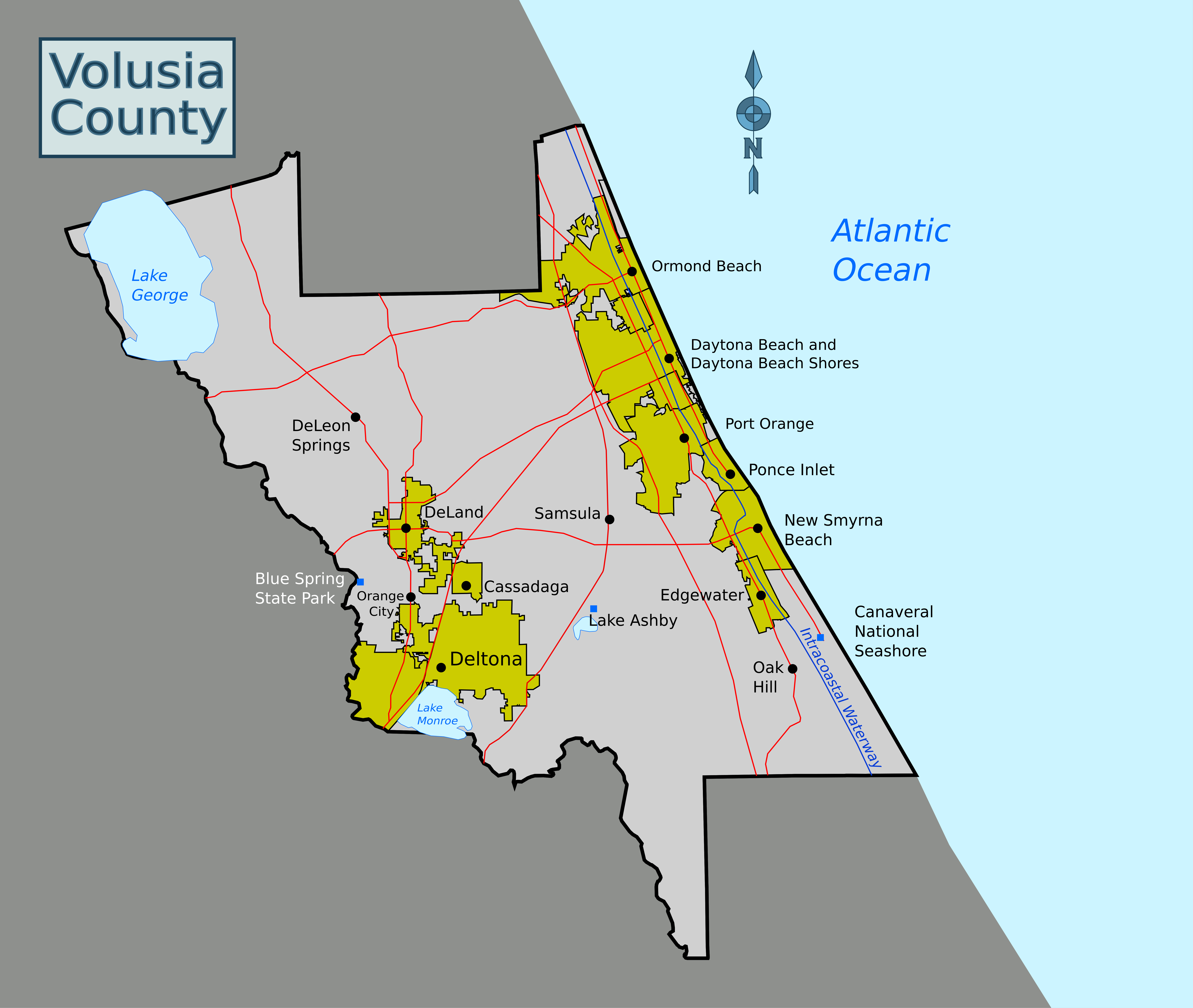
Size of this preview: 710 × 600 pixels. Other resolutions: 284 × 240 pixels | 568 × 480 pixels | 909 × 768 pixels | 1,212 × 1,024 pixels | 2,424 × 2,048 pixels | 7,127 × 6,022 pixels.
Original file (7,127 × 6,022 pixels, file size: 1.69 MB, MIME type: image/png)
This is a file from the Wikimedia Commons and may be used by other projects. Information from its description page there is shown below. Commons is a freely licensed media file repository. |
Summary
| Description | English: Static map for Wikivoyage; SVG file at File:Volusia County static map.svg |
| Date | |
| Source | Base (county border and city limits) from File:Volusia County Florida No Highlights.svg and bodies of water and roads traced from openstreetmap.org |
| Author | Gamweb, SelfieCity |
Licensing
This file is licensed under the Creative Commons Attribution-Share Alike 3.0 Unported license.
- You are free:
- to share – to copy, distribute and transmit the work
- to remix – to adapt the work
- Under the following conditions:
- attribution – You must give appropriate credit, provide a link to the license, and indicate if changes were made. You may do so in any reasonable manner, but not in any way that suggests the licensor endorses you or your use.
- share alike – If you remix, transform, or build upon the material, you must distribute your contributions under the same or compatible license as the original.
File history
Click on a date/time to view the file as it appeared at that time.
| Date/Time | Thumbnail | Dimensions | User | Comment | |
|---|---|---|---|---|---|
| current | 23:37, 18 September 2021 | | 7,127 × 6,022 (1.69 MB) | SelfieCity | add compass |
| 23:35, 18 September 2021 |  | 7,127 × 6,022 (1.66 MB) | SelfieCity | map title | |
| 15:51, 18 September 2021 |  | 7,127 × 6,022 (1.61 MB) | SelfieCity | redraw boundaries for traveler's point of view; add Edgewater and Oak Hill; remove mistaken boundary near Canaveral National Seashore | |
| 18:18, 6 September 2021 |  | 5,558 × 5,988 (1.59 MB) | SelfieCity | Cropped < 1 % horizontally, 24 % vertically using CropTool with precise mode. | |
| 17:58, 6 September 2021 |  | 5,566 × 7,872 (1.63 MB) | SelfieCity | Uploaded a work by User:Gamweb from Base (county border and city limits) from File:Volusia County Florida No Highlights.svg and bodies of water and roads traced from openstreetmap.org with UploadWizard |
File usage
The following page uses this file:
Metadata
Explore the world

United states
New York

Japan
Tokyo

Singapore
Singapore
