
 Français
 Italiano
Size of this PNG preview of this SVG file: 502 × 600 pixels. Other resolutions: 201 × 240 pixels | 402 × 480 pixels | 643 × 768 pixels | 857 × 1,024 pixels | 1,714 × 2,048 pixels | 1,047 × 1,251 pixels.
Original file (SVG file, nominally 1,047 × 1,251 pixels, file size: 147 KB)
This is a file from the Wikimedia Commons and may be used by other projects. Information from its description page there is shown below. Commons is a freely licensed media file repository. |
Summary
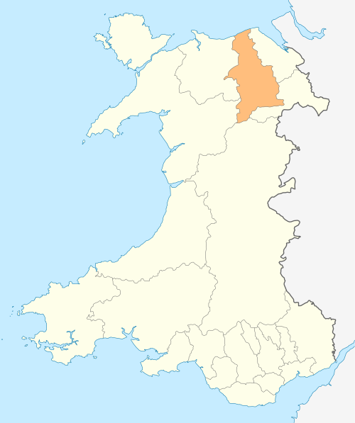
| Description | Deutsch: Lagekarte von Denbighshire in Wales English: Locator map of Denbighshire in Wales |
| Date | |
| Source | Own work |
| Author | NordNordWest |
| Permission (Reusing this file) | I, the copyright holder of this work, hereby publish it under the following license: This file is licensed under the Creative Commons Attribution-Share Alike 3.0 Unported license.
|
 | This map has been made or improved in the German Kartenwerkstatt (Map Lab). You can propose maps to improve as well. |
File history
Click on a date/time to view the file as it appeared at that time.
| Date/Time | Thumbnail | Dimensions | User | Comment | |
|---|---|---|---|---|---|
| current | 18:51, 4 May 2010 | | 1,047 × 1,251 (147 KB) | NordNordWest | {{int:filedesc}} {{Information |Description= {{de|Lagekarte von Denbighshire in Wales}} {{en|Locator map of Denbighshire in Wales}} |Source={{Own}} |Date=2010-05-04 |Author={{U|NordNordWest}} |Permission={{self|cc-by-sa-3.0}} |other_versions= }} {{Karten |
File usage
There are no pages that use this file.
Global file usage
The following other wikis use this file:
- Usage on bg.wikipedia.org
- Usage on en.wikipedia.org
- Llangollen
- Berwyn range
- Ruthin
- Denbighshire
- Rhyl
- St Asaph
- Prestatyn
- Rhuddlan
- Corwen
- Denbigh
- Bodelwyddan
- Gwyddelwern
- Loggerheads, Denbighshire
- Foel Fenlli
- Clwydian Range
- Moel Gyw
- Cadair Bronwen
- Cynwyd, Denbighshire
- River Alyn
- Nantglyn
- Llandyrnog
- Glyndyfrdwy
- Llanarmon-yn-Iâl
- Template:Denbighshire-geo-stub
- Eglwyseg
- Horseshoe Pass
- Llandegla
- Henllan
- Alyn Gorge
- Llandegla Forest
- Meliden
- Dyserth
- World's End, Denbighshire
- Llanferres
- Milltir Cerrig
- Llanelidan
- Tremeirchion
- Trefnant
- Llandrillo, Denbighshire
- Cader
- Bodfari
- Bontuchel
- Wreocensæte
- Llanfair Dyffryn Clwyd
- Tafarn-y-Gelyn
- Denbigh Moors
- Bryn Alyn
- Commins, Denbighshire
- Llanbedr Dyffryn Clwyd
View more global usage of this file.
Explore the world

United states
New York

Japan
Tokyo

Singapore
Singapore
