
 Français
 Italiano
Size of this PNG preview of this SVG file: 502 × 600 pixels. Other resolutions: 201 × 240 pixels | 402 × 480 pixels | 643 × 768 pixels | 857 × 1,024 pixels | 1,714 × 2,048 pixels | 1,047 × 1,251 pixels.
Original file (SVG file, nominally 1,047 × 1,251 pixels, file size: 152 KB)
This is a file from the Wikimedia Commons and may be used by other projects. Information from its description page there is shown below. Commons is a freely licensed media file repository. |
Summary
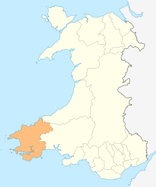
| Description | Deutsch: Lagekarte von Pembrokeshire in Wales English: Locator map of Pembrokeshire in Wales |
| Date | |
| Source | Own work |
| Author | NordNordWest |
| Permission (Reusing this file) | I, the copyright holder of this work, hereby publish it under the following license: This file is licensed under the Creative Commons Attribution-Share Alike 3.0 Unported license.
|
 | This map has been made or improved in the German Kartenwerkstatt (Map Lab). You can propose maps to improve as well. |
File history
Click on a date/time to view the file as it appeared at that time.
| Date/Time | Thumbnail | Dimensions | User | Comment | |
|---|---|---|---|---|---|
| current | 18:56, 4 May 2010 | | 1,047 × 1,251 (152 KB) | NordNordWest | {{int:filedesc}} {{Information |Description= {{de|Lagekarte von Pembrokeshire in Wales}} {{en|Locator map of Pembrokeshire in Wales}} |Source={{Own}} |Date=2010-05-04 |Author={{U|NordNordWest}} |Permission={{self|cc-by-sa-3.0}} |other_versions= }} {{Kart |
File usage
There are no pages that use this file.
Global file usage
The following other wikis use this file:
- Usage on cs.wikipedia.org
- Usage on en.wikipedia.org
- Pembrokeshire
- Pembroke Castle
- Haverfordwest
- Pembroke, Pembrokeshire
- Pembrokeshire Coast National Park
- Skokholm
- Skomer
- Grassholm
- Gateholm
- Middleholm
- Ramsey Island
- Caldey Island
- Milford Haven
- Newport, Pembrokeshire
- Tenby
- Pembroke Dock
- Cilgerran
- Neyland
- Manorbier
- Nevern
- Carew Castle
- Strumble Head
- Crow Rock
- Wolf's Castle
- Spittal, Pembrokeshire
- Mynachlog-ddu
- Stackpole
- Crymych
- Dale, Pembrokeshire
- St Margaret's Island
- Ynys Bery
- Bishops and Clerks
- Emsger
- List of places in Pembrokeshire
- Manorbier Castle
- Amroth
- Cilgerran Castle
- St Dogmaels
- Wiston, Pembrokeshire
- Abereiddy
- Dinas Cross
- Narberth, Pembrokeshire
- Saundersfoot
- Penally
- Lamphey
- Clynderwen
- Oakwood Theme Park
- Johnston, Pembrokeshire
- Wisemans Bridge
View more global usage of this file.
Explore the world

United states
New York

Japan
Tokyo

Singapore
Singapore
