Size of this PNG preview of this SVG file: 484 × 600 pixels. Other resolutions: 194 × 240 pixels | 387 × 480 pixels | 620 × 768 pixels | 826 × 1,024 pixels | 1,652 × 2,048 pixels | 990 × 1,227 pixels.
Original file (SVG file, nominally 990 × 1,227 pixels, file size: 612 KB)
File history
Click on a date/time to view the file as it appeared at that time.
| Date/Time | Thumbnail | Dimensions | User | Comment | |
|---|---|---|---|---|---|
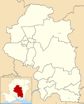
| current | 12:15, 30 April 2016 |  | 990 × 1,227 (612 KB) | Nilfanion | {{Information |Description=Map of Winchester, Hampshire, UK with electoral wards as of 2016 shown. Equirectangular map projection on WGS 84 datum, with N/S stretched 155% Geographic limits: *West: 1.47W *East: 1.02W *North: 51.21N *South: 50.85N |Sou... |
File usage
There are no pages that use this file.
Global file usage
The following other wikis use this file:
- Usage on en.wikipedia.org
- Winchester
- Wickham, Hampshire
- Bishop's Waltham
- City of Winchester
- New Alresford
- Whiteley
- Kings Worthy
- Hursley
- Widley
- Otterbourne
- Exton, Hampshire
- Hambledon, Hampshire
- List of civil parishes in Hampshire
- Tichborne
- Denmead
- Twyford, Hampshire
- Colden Common
- Badger Farm
- Beauworth
- Bighton
- Micheldever
- Cheriton, Hampshire
- Bishops Sutton
- Boarhunt
- Owslebury
- Southwick, Hampshire
- Compton and Shawford
- Old Alresford
- Itchen Valley
- Oliver's Battery
- West Meon
- Droxford
- Meonstoke
- Corhampton
- Sparsholt, Hampshire
- Bramdean and Hinton Ampner
- Swanmore
- Soberton
- Crawley, Hampshire
- Chilcomb
- Durley
- Curdridge
- Winchester City Council elections
- Headbourne Worthy
- Kilmeston
- Northington
- Shedfield
- Upham, Hampshire
- Warnford
- Wonston
View more global usage of this file.


 Français
 Italiano


