
 Français
 Italiano
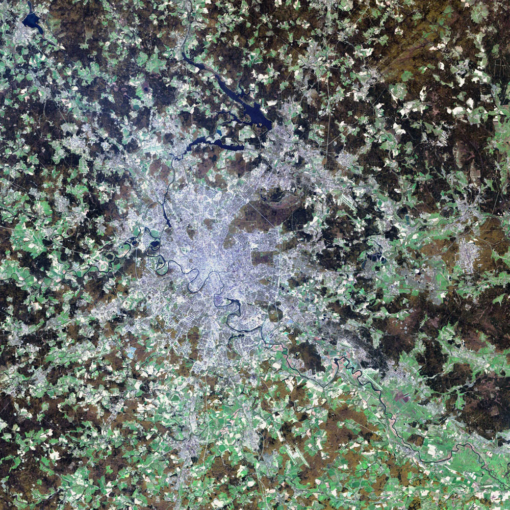
Tamaño de esta previsualización: 600 × 600 píxeles. Otras resoluciones: 240 × 240 píxeles | 480 × 480 píxeles | 1000 × 1000 píxeles.
Archivo original (1000 × 1000 píxeles; tamaño de archivo: 396 kB; tipo MIME: image/jpeg)
Éste es un archivo de Wikimedia Commons, un depósito de contenido libre hospedado por la Fundación Wikimedia
Más abajo se reproduce su página de descripción con la información sobre su origen y licencia.
Resumen
| Descripción | Deutsch: Satellitenbild von de:Moskau English: satellite image of the city of en:Moscow.
|
| Fecha | 2 de agosto de 2002 |
| Fuente | NASA Visible Earth project, http://visibleearth.nasa.gov/view_rec.php?id=3434 |
| Autor | NASA/USGS EROS Data Center Satellite Systems Branch/Landsat 7/ETM+ |
Licencia
Esta imagen está en el dominio público, ya que contiene materiales que originalmente vinieron del Servicio Geológico de los Estados Unidos de América, una agencia del Departamento del Interior. Para obtener más información, consulte la política oficial de derechos de los USGS.
|
| Este archivo es de dominio público porque fue creado por la NASA. Las políticas sobre copyright de la NASA estipulan que «el material de la NASA no está protegido con copyright a menos que se indique lo contrario». (Políticas sobre copyright de la NASA o Políticas sobre la utilización de imágenes del Jet Propulsion Laboratory). | ||
 | Advertencias:
|
Historial del archivo
Haz clic sobre una fecha y hora para ver el archivo tal como apareció en ese momento.
| Fecha y hora | Miniatura | Dimensiones | Usuario | Comentario | |
|---|---|---|---|---|---|
| actual | 05:12 8 nov 2004 | | 1000 × 1000 (396 kB) | Ævar Arnfjörð Bjarmason |
Usos del archivo
No hay páginas que enlacen a este archivo.
Uso global del archivo
Las wikis siguientes utilizan este archivo:
- Uso en af.wikipedia.org
- Uso en ar.wikipedia.org
- Uso en be-tarask.wikipedia.org
- Uso en ca.wikipedia.org
- Uso en hif.wikipedia.org
- Uso en hr.wikipedia.org
- Uso en hu.wiktionary.org
- Uso en it.wikipedia.org
- Uso en kk.wikipedia.org
- Uso en lb.wikipedia.org
- Uso en my.wikipedia.org
- Uso en roa-tara.wikipedia.org
- Uso en ru.wikipedia.org
- Uso en sh.wikipedia.org
- Uso en sl.wikipedia.org
- Uso en yi.wikipedia.org
Metadatos
Explore the world

United states
New York

Japan
Tokyo

Singapore
Singapore
